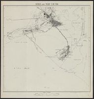
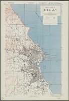
"Advance ed." 1942, by Corps of Engineers, was indexed as part of series G. S. G. S. 4241., "Reference" gives key to points of interest; a few streets are named., In upper margin: Morocco., and Military grid.
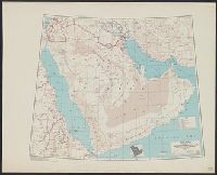
"Lambert conformal conic projection.", "Strategic area" includes all of Arabian peninsula. Three classes of roads or trails and three classes of railroads are shown., Elevations are shown by hachures and spot heights in meters., and Inset shows area with detaile
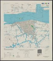
"Lambert conformal conic projection.", Elevations are shown by hachures and spot heights in meters., Inset shows area with detailed transportation information., and Two classes of roads and five classes of railroads are shown.
Subject (Topic):
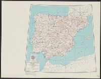
Transportation--Portugal--Maps and Transportation--Spain--Maps
Its A.M.S. 6201 and Series (Standard map series designation system) ; 6201.
Description:
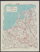
"Lambert conformal conic projection.", Elevations shown by hachures and spot heights in meters., and Two classes of roads and five classes of railroads are shown.
Subject (Topic):
Transportation--Belgium--Maps, Transportation--Luxembourg--Maps, and Transportation--Netherlands--Maps
Geographical Section, General Staff ; no. 4241 and GSGS (Series) ; 4241.
Description:
"Compiled by Army Map Service, U. S. A. 1942. Revised ... by War Office, 1943.", "Form line interval 20 feet (approximate)", Important streets are named., In upper margin: Morocco ..., and Military grid.
Its A.M.S. ; L901 and Series (Standard map series designation system) ; L901.
Description:
"Contour interval 20 meters.", "Place names transcribed according to the modified Wade-Giles system.", "Polyconic projection.", In upper margin: China city plans., Includes "Glossary.", Marginal maps: Covera, Military grid., and Some streets and buildings are named.