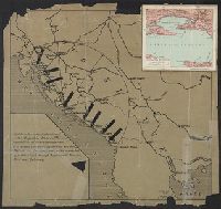
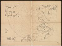
Ancillary map affixed to upper right corner of map, titled "Spalato e dintorni", scale 1:200,000. and Shows Yugoslavian port of Spalato, with arrows pointing to it and nearby ports.
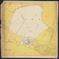
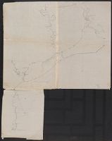
North east districts, Portland., North-northwest district, Portland., S.E. district Portland., and S.W. district Portland.
Description:
Copyright: Henry R. Staats., Indexed., Sheets of map separately titled: North-northwest district, Portland -- North east districts, Portland -- S.W. district Portland -- S.E. district Portland., and Title devised by cataloger.
Des Barres, Joseph F. W. (Joseph Frederick Wallet), 1722-1824
Published / Created:
1775?-1781?]
Call Number:
1983 Folio 25
Image Count:
3
Resource Type:
Maps, Atlases & Globes
Abstract:
A made-up collection of charts, plans and views, partly hand colored, from the Atlantic Neptune comprising [v. 1]: the charts of the South East Coast of Nova Scotia, with the title page of The charts of the coast and harbors of New England, 1781 bound in front (31 items, dated between 1777 and 1781). [v. 2]: Charts of the coast and harbours in the Gulph and river of St. Lawrence, 1780, including the charts of the coast of New England (36 items, dated between 1775 and 1781). [v. 3]: Charts of several harbours and divers parts of the coast of North America from New York south westwards to the Gulph of Mexico, 1780, including some 16 charts belonging to the New England part of the work (35 items, dated between 1776 and 1781). General title page wanting.
Description:
Includes indexes.
Publisher:
The Admiralty,
Subject (Geographic):
North America--Maps and North America--Pictorial works
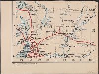
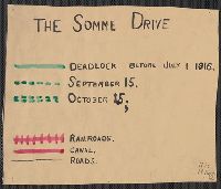
"Situation map" stamped in lower right corner., Red lines indicate fluctuating location of the Western Front, with dates of "March 21" through "March 31", year unspecified., and Shows Amiens to the west and St. Quentin to the east.