Skip to search
Skip to main content
Skip to first result
Search
You Searched For
Format
cartographic
Genre
Maps
New Search
Search Results
Creator:
Published / Created:
1794
Call Number:
795cea 1794
Container / Volume:
BRBL_00523
Image Count:
1
Resource Type:
Maps, Atlases & Globes
Description:
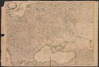
Depths shown by soundings., In upper right margin: DE.2., and Prime meridians: Ferro and London.
Publisher:
Laurie & Whittle,
Subject (Geographic):
Gulf Coast (U.S.)--Maps--Early works to 1800
Subject (Name):
Robert Laurie and James Whittle and Streeter, Thomas W.--(Thomas Winthrop),--1883-1965--Ownership
Subject (Topic):
Coasts--Gulf States--Maps--Early works to 1800, Coasts--Louisiana--Maps--Early works to 1800, and Coasts--Texas--Maps--Early works to 1800
Found in:
Beinecke Rare Book and Manuscript Library > The western coast of Louisiana and the coast of New Leon / by Thos. Jefferys, geographer to His Majesty.
Published / Created:
1777
Call Number:
755 1777C
Container / Volume:
BRBL_00431
Image Count:
1
Resource Type:
Maps, Atlases & Globes
Description:
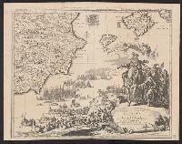
See Phillips 589-9. and View of Niagara Falls.
Publisher:
Sr. le Rouge Ingenieur Geographe du Roy,
Subject (Geographic):
Canada--Maps--Early works to 1800 and East (U.S.)--Maps--Early works to 1800
Found in:
Beinecke Rare Book and Manuscript Library > Theatre de la Guerre en Amérique.
Published / Created:
1741
Call Number:
435 1741
Container / Volume:
BRBL_00252
Image Count:
1
Resource Type:
Maps, Atlases & Globes
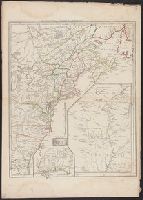
Description:
Clumnitz Chateau, 7 x 9., Einbogen, Chateau de Brandeis, Budweiss, Eger, Kolin, Leutmaritz, Pilsen, Thabor., Insets: Prag, Ville Capitale, ca 1:45,000, 11 x 15., and Koniggratz [Hradec Králové], 7 x 9.
Publisher:
Chez le Sr. le Rouge,
Subject (Geographic):
Bohemia (Czech Republic)--Maps--Early works to 1800
Found in:
Beinecke Rare Book and Manuscript Library > Theatre de la Guerre en Boheme avec les principaux Postes de ce Royaume. Ingr. Geogphe du Roy ...
Creator:
Published / Created:
1777
Call Number:
755 1777G
Container / Volume:
BRBL_00431
Image Count:
1
Resource Type:
Maps, Atlases & Globes
Description:
"Avec privilege du Roi". and Insets: [1.] Sault du Niagara, de 135 pieds de haut -- [2. Map of Louisiana territory] -- [3. Map of Mississippi River region].
Publisher:
[Georges-Louis le Rouge], rue des Augustins,
Subject (Geographic):
North America--Maps--Early works to 1800 and United States--History--Revolution, 1775-1783--Maps--Early works to 1800
Found in:
Beinecke Rare Book and Manuscript Library > Theatre de la guerre en Amérique / par le Sr. le Rouge, ingenieur, geographe du Roy.
Creator:
Published / Created:
[1706]
Call Number:
39 1706A
Container / Volume:
BRBL_00185
Image Count:
1
Resource Type:
Maps, Atlases & Globes
Alternative Title:
Theatre de la guerre en Espagne et en Portugal. and Theatre de la guerre en Espagne, &c
Description:
Shows northeastern Spain, southwestern France.
Publisher:
Par I. Cóvens et C. Mortier,
Subject (Geographic):
Spain, Northern--Maps--Early works to 1800
Found in:
Beinecke Rare Book and Manuscript Library > Theatre de la guerre en Espagne, etc.
Branch:v1.61.8 ,Deployed:2024-06-20T11:14:46-04:00