Skip to search
Skip to main content
Skip to first result
Search
You Searched For
Extent of Digitization
Partially digitized
Genre
Engravings
New Search
Search Results
Published / Created:
1774 November 29
Call Number:
1975 Folio 51
Collection Title:
The American atlas; or, A geographical description of the whole continent of America; wherein are
Image Count:
1
Resource Type:
Maps, Atlases & Globes
Description:
Stamped on verso: 16.
Subject (Geographic):
America --Maps --Early works to 1800, Connecticut --Maps --Early works to 1800, Massachusetts --Maps --Early works to 1800, New England --Maps --Early works to 1800, and Rhode Island --Maps --Early works to 1800
Subject (Name):
Holland, Samuel, 1728-1801
Collection Created:
London, Printed by R. Sayer and J. Bennett, 1776
Found in:
Beinecke Rare Book and Manuscript Library > A map of the most inhabited part of New England, containing the provinces of Massachusets Bay and New Hampshire, with the colonies of Conecticut and Rhode Island, divided into counties and townships: the whole composed from actual surveys and its situatio
Call Number:
1977 +392
Collection Title:
A survey of the cities of London and Westminster : containing the original, antiquity, increase
Image Count:
1
Resource Type:
Maps, Atlases & Globes
Description:
Plate between p. 44-45.
Subject (Geographic):
London (England)--History
Collection Created:
London : Printed for A. Churchill, J. Knapton, R. Knaplock, J. Walthoe [and 6 others], 1720
Found in:
Beinecke Rare Book and Manuscript Library > A map of the parish if St. Katherines by the Tower
Call Number:
1977 +392
Collection Title:
A survey of the cities of London and Westminster : containing the original, antiquity, increase
Image Count:
1
Resource Type:
Maps, Atlases & Globes
Description:
Plate between p. 46-47.
Subject (Geographic):
London (England)--History
Collection Created:
London : Printed for A. Churchill, J. Knapton, R. Knaplock, J. Walthoe [and 6 others], 1720
Found in:
Beinecke Rare Book and Manuscript Library > A map of the parish of St. Dustans Stepney and Stebunheath divided into hamlets
Call Number:
1977 +392
Collection Title:
A survey of the cities of London and Westminster : containing the original, antiquity, increase
Image Count:
1
Resource Type:
Maps, Atlases & Globes
Description:
Plate between p. 108-109.
Subject (Geographic):
London (England)--History
Collection Created:
London : Printed for A. Churchill, J. Knapton, R. Knaplock, J. Walthoe [and 6 others], 1720
Found in:
Beinecke Rare Book and Manuscript Library > A mapp of the parishes of St. Clements Danes, St. Mary Savoy; with the Rolls Liberty and Lincolns Inn, taken from the last survey with corrections and additions
Call Number:
1977 +392
Collection Title:
A survey of the cities of London and Westminster : containing the original, antiquity, increase
Image Count:
1
Resource Type:
Maps, Atlases & Globes
Description:
Plate between p. 26-27.
Subject (Geographic):
London (England)--History
Collection Created:
London : Printed for A. Churchill, J. Knapton, R. Knaplock, J. Walthoe [and 6 others], 1720
Found in:
Beinecke Rare Book and Manuscript Library > A mapp of the parishes of St. Saviours Southwark and St. Georges taken from the last survey with corrections
Creator:
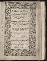
Call Number:
Taylor 180
Collection Title:
A mirror for mathematiques: a golden gem for geometricians: a sure safety for saylers, and an
Image Count:
4
Description:
Title within ornamental border. Running title: The trauailers ioy and felicitie.
Subject (Topic):
Geometry --Early works to 1800., Mathematics --Early works to 1800., and Nautical astronomy --Early works to 1800
Collection Created:
Imprinted at London, By J. C. and are to be sold in Paules Churchyard, by Richard Watkins, 1587
Found in:
Beinecke Rare Book and Manuscript Library > A mirror for mathematiques: a golden gem for geometricians ...
Creator:
Call Number:
Folio Shirley 11
Collection Title:
Engravings on wood : by members of the Society of American Wood-engravers / with an introduction
Image Count:
1
Subject (Topic):
Wood-engraving, American
Collection Created:
New York : Harper and Brothers, 1887
Found in:
Beinecke Rare Book and Manuscript Library > A morning
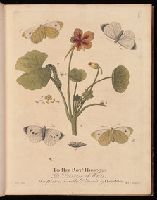
Creator:
Published / Created:
1720
Call Number:
St11 G5 +720a
Image Count:
1
Publisher:
Printed for the author: and sold by William and John Innys at the West end of St Pauls,
Subject (Topic):
Insects--Great Britain and Insects--Pictorial works
Found in:
Beinecke Rare Book and Manuscript Library > A natural history of English insects / illustrated with a hundred copper plates, curiously engraven from the life ; and ... coloured by the author Eleazar Albin, painter.
Call Number:
1973 Folio 114
Collection Title:
The English pilot: describing the West-India navigation, from Hudson's-Bay to the river Amazones
Image Count:
1
Resource Type:
Maps, Atlases & Globes
Subject (Geographic):
Atlantic Ocean --Maps --Early works to 1800 and Newfoundland and Labrador --Maps --Early works to 1800
Subject (Topic):
Navigation --Early works to 1800, Pilot guides --Atlantic Coast (U.S.) --Early works to 1800, and Pilot guides --Caribbean Area --Early works to 1800
Collection Created:
London : Printed for W. and J. Mount, T. Page and son, on Tower-Hill, MDCCLIX [1759]
Found in:
Beinecke Rare Book and Manuscript Library > A new and correct chart of the coast of New Foundland from Cape Raze to Cape Bonavista
Call Number:
1973 Folio 114
Collection Title:
The English pilot: describing the West-India navigation, from Hudson's-Bay to the river Amazones
Image Count:
1
Resource Type:
Maps, Atlases & Globes
Subject (Geographic):
Atlantic Ocean --Maps --Early works to 1800, Canada --Maps --Early works to 1800, and Newfoundland and Labrador --Maps --Early works to 1800
Subject (Topic):
Navigation --Early works to 1800, Pilot guides --Atlantic Coast (U.S.) --Early works to 1800, and Pilot guides --Caribbean Area --Early works to 1800
Collection Created:
London : Printed for W. and J. Mount, T. Page and son, on Tower-Hill, MDCCLIX [1759]
Found in:
Beinecke Rare Book and Manuscript Library > A new and correct chart of the north part of America from New Found Land to Hudsons Bay
Branch:v1.61.8 ,Deployed:2024-06-20T11:14:48-04:00