Jovrnal ou Description dv merveillevx voyage de Gvillavme Schovten, hollandois natif de Hoorn
Image Count:
1
Description:
Bound in facing p. 24., Imperfect: map has a defect just left of center in the form of a narrow vertical wrinkle that occurred at the time of printing, resulting in a line where no ink was deposited on the page, which also caused a small amount of loss of text., Map has several small brown and yellow marks on both the recto and verso., Map has small drop of black ink just left of the word "Latitudinis"., and Scale not given.
Subject (Geographic):
Horn, Cape (Chile), Le Maire Strait (Argentina), New Guinea --Maps --Early works to 1800, Oceania --Maps --Early works to 1800, and Tierra del Fuego (Argentina) --Maps --Early works to 1800
Subject (Name):
Schouten, Willem Corneliszoon, d. 1625
Collection Created:
A Amstredam : Chez Harman Ianson, marchand libraire, demeurant en la VVarmoes-straet, a le Sereine, 1619
Jovrnal ou Description dv merveillevx voyage de Gvillavme Schovten, hollandois natif de Hoorn
Image Count:
1
Description:
Bound in facing p. 20., Map has several small brown marks on both the recto and verso as well as a larger one in the center that can be seen on both the recto and verso., and Scale not given.
Subject (Geographic):
Horn, Cape (Chile), Le Maire Strait (Argentina), and Tierra del Fuego (Argentina) --Maps --Early works to 1800
Subject (Name):
Schouten, Willem Corneliszoon, d. 1625
Collection Created:
A Amstredam : Chez Harman Ianson, marchand libraire, demeurant en la VVarmoes-straet, a le Sereine, 1619
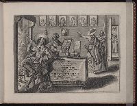
Pickaert, Pieter, 1668 or 9-ca. 1732 Scherm, Laurens Schoonebeek, Adriaan, 1657 or 8-1705
Published / Created:
[1692?]
Call Number:
2008 +141
Image Count:
65
Abstract:
A series of sixty plates published in Amsterdam and with captions in Dutch and French, this work illustrates the Glorious Revolution in England, from the flight of James II through the coronation of William and Mary.
Alternative Title:
Engelands schouwtoneel and Theatre d’Angleterre
Publisher:
by Adr. Schoonebeek in de Kalverstraat
Subject (Geographic):
Great Britain --History --James II, 1685-1688 --Pictorial works, Great Britain --History --Revolution of 1688 --Pictorial works, and Great Britain --History --William and Mary, 1689-1702 --Pictorial works
Descriptio ac delineatio geographica detectionis freti, sive, transitus ad occasum supra terras
Image Count:
1
Abstract:
Map depicts the Coat of Arms of the United Kingdom (era of the Union of the Crowns), reigning between the years 1603-1707.
Alternative Title:
Tabula nautica, qua repraesentantur orae maritimae, meatus, ac freta, noviter a H. Hudsono Anglo ad Caurum supra Novam Franciam
Description:
Bound in after p. [2]., In pencil on recto: 170., Map cut and folded irregularly., Map has multiple small stains on both the recto and verso., and Scale [ca. 1:9,000,000].