Principal islands in America belonging to the English empire viz Jamaica, Barbados, Antegoa, St. Christophers & Bermudos
Description:
[Antigua and Bermuda Islands] -- A general map of the Cariby Islands -- [Saint Kitts] -- [Barbados] -- The explanation of the marks on the island of Iamaica., Bar scale given in miles., No. 62 of 69 maps bound together in composite atlas., Relief shown pictorially., and Scales differ.
Publisher:
Sold by Phillip Lea at the Atlas and Hercules in Cheapside
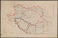
Dominions of Turky in Europe in which are the governments of Romelia of the sea, of Buda, of Teme's war, and of Bosnia ... described by Sanson, corrected and amended by William Berry
Description:
Bar scales in Italian miles, common leagues of France, common leagues of Germany or great leagues of Poland, leagues of Hungary, and leagues that are of one hours travelling., Dedicated To the most serene and most sacred majesty Charles II ... by William Berry., No. 24 of 69 maps bound together in composite atlas., Relief shown pictorially., and Scale [ca. 1:3 500 000].
Publisher:
Sold by William Berry at the signe of the Globe between Charing-Cross and White-Hall
Subject (Geographic):
Balkan Peninsula --Maps --Early works to 1800, Italy --Maps --Early works to 1800, and Turkey --Maps --Early works to 1800
Bar scales given in English miles and Spanish leagues., Includes inset maps The Groyne, A general chart from England to Spain, Vigo and Bayonna, Porto, Lisbon and St. Ubes, and The harbour of Cadiz., No. 9 of 69 maps bound together in composite atlas., Relief shown pictorially., and Scale [ca. 1:1 800 000].
Publisher:
Sold by Christopher Browne at the Globe near the west end of St. Pauls Church
All volumes bound to match 1973 Folio 72. Factitious collection of about 549 maps taken from the atlases of the 17th and the beginning of the 18th cent., put together with the title "Atlas" and bound in 6 volumes. These volumes originally bore the imprint: Amstelaedamii apvd Reiniervm & Josvam Ottens. Over these words on the title-pages of v. 1-2, 4-6 is the name of Henrik de Leth who painted them. Volume 3 has only the erased imprint of Ottens., For fuller description see Phillips 3448 and C. Koeman's Atlantes Neerlandici, bibliography of terrestrial, maritime and celestial atlases and pilot books, published in the Netherlands up to 1800, Amsterdam c1967-71, v. 2, p. 63-83., and Maps by P. Schenck and son, G. Valck, F. de Wit, N. Visscher and others.
Publisher:
chez J. Covens & C. Mortier,
Subject (Geographic):
Denmark --Maps --Early works to 1800
Subject (Name):
Reiner et Josua Ottens (Firm), Schenk, Peter, 1660-1718 or 1719., and Valck, G. (Gerard), 1651 or 1652-1726.
BEIN Series 304 1886A: Imperfect: all sheets but C2-4, D2-4, E2-4 wanting., In upper margin of some maps: Domborzati áttekintés., Maps individually numbered and subtitled in upper margin, e.g.: B.4. Pola, Zara, Comacchio -- C2. Brno -- D.2. Kassa és Kraków -- E3. Koloszvár -- F.3. Bielcy, Kisziniew, Jassi., Publisher's name in lower margin differs: M. Kir. Térképészeti Intézet -- M. Kir. Állami Térképészeti Intézet -- M. Kir. Állami Térképészet -- M.kir. állami térképészet nyomása., Subtitles for the same map may differ according to ed., Title devised by cataloger., and Various eds. of some maps.