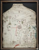
1. Portolan chart of the Mediterranean Sea, the North Atlantic Ocean, the Black Sea, and the West Creator: Aguilar, Jorge de. Published / Created: no anno dominus nostris Jh[es]u Xpi de 1492. Call Number: Art Storage 30cea 1492 Image Count: 2 Resource Type: Maps, Atlases & Globes Found in: Beinecke Rare Book and Manuscript Library > Portolan chart of the Mediterranean Sea, the North Atlantic Ocean, the Black Sea, and the West African coast as far south as Sierra Leone.