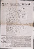
Broeck, Crispin van den, 1524-ca. 1591 Visscher, Nicolaes, 1618-1679
Published / Created:
[ca. 1660]
Call Number:
1983 Folio 19
Collection Title:
[Atlas factice of 96 maps by Blaeu, Visscher, Jansson, Hondius and others]
Image Count:
2
Alternative Title:
Armenia Maior and Asia et Armenia Minor
Description:
Imperfect: illustrations at top cut-out and replaced with ms. titles "Asia et Armenia minor" (upper left) and "Armenia minor" (in upper right); torn along fold and at left edge, with some loss of text. Sheet measures 32 x 47.8 cm. Reinforced along edges with printed waste. No. 85 of 92 maps bound together. and Numbered 91 on verso.
Publisher:
[Nicolaes Visscher]
Subject (Geographic):
Armenia --Maps --Early works to 1800, Assyria --Maps, Egypt --Maps --Early works to 1800, Middle east --Maps --Early works to 1800, Palestine --Geography --Maps --Early works to 1800, Saudi Arabia --Maps, Syria --Maps, and Turkey --Maps
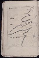
The English pilot: describing the sea-coasts, capes, head-lands, rivers, bays, roads, havens
Image Count:
2
Description:
Most maps numbered in pencil on verso, some on recto.
Subject (Geographic):
Atlantic Ocean --Maps --Early works to 1800 and Newfoundland and Labrador --Maps --Early works to 1800
Subject (Topic):
Navigation --Early works to 1800, Pilot guides --Atlantic Coast (U.S.) --Early works to 1800, and Pilot guides --Caribbean Area --Early works to 1800
Collection Created:
London : Printed for John Thornton, at the sign of the England, Scotland, and Ireland, in the Minories, and Richard Mount, at the Postern on Tower-Hill, 1698London : Printed for John Thornton, at the sign of the England, Scotland, and Ireland, in the Minories, and Richard Mount, at the Postern on Tower-Hill, 1698