Search
You Searched For
Search Results
- Published / Created:
- 1870
- Call Number:
- 779 W27 1870
- Container / Volume:
- BRBL_00505A
- Image Count:
- 1
- Resource Type:
- Maps, Atlases & Globes
- Found in:
- Beinecke Rare Book and Manuscript Library > Map of the City of Washington.
- Published / Created:
- [1855?].
- Call Number:
- 75gme 1855
- Container / Volume:
- BRBL_00411
- Image Count:
- 1
- Resource Type:
- Maps, Atlases & Globes
- Found in:
- Beinecke Rare Book and Manuscript Library > Map of the Clinton Line Railroad and its connections.
- Published / Created:
- 1852?]
- Call Number:
- 88cea C632 1851
- Container / Volume:
- BRBL_00648
- Image Count:
- 1
- Resource Type:
- Maps, Atlases & Globes
- Found in:
- Beinecke Rare Book and Manuscript Library > Map of the Coatzacoalcos River : from Mina-Titlan to the Isla del Suchil and of the Jaltepec River from its junction to the railroad crossing, surveyed by the hydrographic party, under the command of Wm. G. Temple / drawn by Louis R.O. Townsend ; lith. of
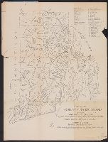
- Creator:
- Rider, Sidney S. (Sidney Smith), 1833-1917
- Published / Created:
- 1903
- Call Number:
- 765 1904
- Container / Volume:
- BRBL_00463
- Image Count:
- 1
- Resource Type:
- Maps, Atlases & Globes
- Found in:
- Beinecke Rare Book and Manuscript Library > Map of the Colony of Rhode Island : giving the Indian names of locations and the locations of great events in Indian history with present political divisions indicated / by Sidney S. Rider.
- Published / Created:
- 1912?]
- Call Number:
- 80gme 1912A
- Container / Volume:
- BRBL_00540
- Image Count:
- 2
- Resource Type:
- Maps, Atlases & Globes
- Found in:
- Beinecke Rare Book and Manuscript Library > Map of the Colorado & Southern lines and affiliated lines / engraved by American Bank Note Co., New York.
- Creator:
- Parkinson, T. D
- Published / Created:
- [1875?]
- Call Number:
- 837gfc C739 1875
- Container / Volume:
- BRBL_00595
- Image Count:
- 1
- Resource Type:
- Maps, Atlases & Globes
- Found in:
- Beinecke Rare Book and Manuscript Library > Map of the Comstock Lode and the Washoe mining claims in Storey & Lyon counties, Nevada : compiled from official surveys and other reliable data / by T.D. Parkinson.
- Published / Created:
- 1839
- Call Number:
- 53 1839
- Container / Volume:
- BRBL_00284
- Image Count:
- 2
- Resource Type:
- Maps, Atlases & Globes
- Found in:
- Beinecke Rare Book and Manuscript Library > Map of the Countries lying betwen Turkey and Birmah, Comprising Asia Minor, Persia, India, Egypt, and Arabia and including the Black, Caspian, and Red Seas. By James Wyld, Geographer to t he Queen.
- Published / Created:
- 1826
- Call Number:
- 755gma 1826
- Container / Volume:
- BRBL_00442
- Image Count:
- 1
- Resource Type:
- Maps, Atlases & Globes
- Found in:
- Beinecke Rare Book and Manuscript Library > Map of the Country between Washington & Pittsburg referring to the contemplated Chesapeake & Ohio Canal and its general route and profile. Oct. 1826. Drawn by Lieut. Farley, U.S.A. Etched by Wm. Harrison, Georgetown, D.C., Lettered by D.R. Harrison.
- Published / Created:
- 1848
- Call Number:
- 75 1848V
- Container / Volume:
- BRBL_00399
- Image Count:
- 1
- Resource Type:
- Maps, Atlases & Globes
- Found in:
- Beinecke Rare Book and Manuscript Library > Map of the Country between the Atlantic & Pacific Oceans ... shewing the proposed Route of a Rail Road from Mississippi Valley to the parts of St. Diego, Monterey, & San Francisco on the Pacific Coast also the connection of this Road with those of the Atl
- Published / Created:
- 1830
- Call Number:
- 3229 1830
- Container / Volume:
- BRBL_00062
- Image Count:
- 1
- Resource Type:
- Maps, Atlases & Globes
- Found in:
- Beinecke Rare Book and Manuscript Library > Map of the County Palatine of Chester ... by C. & J. Greenwood.