Skip to search
Skip to main content
Skip to first result
Search
You Searched For
Genre
Maps
Publication Place
[Washington, D.C.] :
New Search
Search Results
Creator:
Published / Created:
1899
Call Number:
60fab 1899
Container / Volume:
BRBL_00329
Image Count:
1
Resource Type:
Maps, Atlases & Globes
Publisher:
U.S. Treasury Department,
Subject (Geographic):
Africa--Maps
Found in:
Beinecke Rare Book and Manuscript Library > Africa, its political divisions and commercial routes / Norris Peters Co., photo-litho., Washington, D.C.
Creator:
Published / Created:
1869
Call Number:
848 1869
Container / Volume:
BRBL_00630
Image Count:
1
Resource Type:
Maps, Atlases & Globes
Description:
"No. 20"--Upper right margin., "The Yukon River, ranges of mountains, shores of Norton Sound and many features of the interior from a reconnaissance by W.H. Dall, Director of the Scientific Corps, of the W.U. Tel. Expedition, 1865-1868.", and Inset: Aleutian Islands.
Publisher:
U.S. Coast Survey,
Subject (Geographic):
Alaska--Maps and Yukon Territory--Maps
Subject (Name):
Dall, William Healey, 1845-1927 and Lindenkohl, H. (Henry)
Found in:
Beinecke Rare Book and Manuscript Library > Alaska and adjoining territory / drawn by H. Lindenkohl.
Creator:
Published / Created:
1906
Call Number:
771cbf Al13 1906
Image Count:
1
Resource Type:
Maps, Atlases & Globes
Description:
"Henry Gannet, Chief Geographer, H.M. Wilson, Geographer in charge; Topography by Frank Sutton and J.H. Jennings; surveyed in 1891-1892.", "Reprinted Nov. 1906.", "Surveyed in cooperation with the State of New York.", Contour interval 20 feet., and Relief shown by contours.
Publisher:
U.S. Geological Survey,
Subject (Geographic):
Albany Region (N.Y.)--Maps
Subject (Name):
Gannett, Henry, 1846-1914
Found in:
Beinecke Rare Book and Manuscript Library > Albany and vicinity, New York.
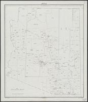
Creator:
Published / Created:
1934
Call Number:
842fb 1930
Container / Volume:
BRBL_00600
Image Count:
1
Resource Type:
Maps, Atlases & Globes
Publisher:
Bureau of the Census,
Subject (Geographic):
Arizona--Administrative and political divisions--Maps
Found in:
Beinecke Rare Book and Manuscript Library > Arizona : minor civil divisions / Department of Commerce, Bureau of the Census, 1930.
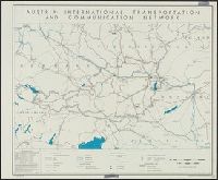
Creator:
Published / Created:
1945
Call Number:
42gm 1945
Container / Volume:
BRBL_00245
Image Count:
1
Resource Type:
Maps, Atlases & Globes
Description:
"Data as of 1938 with some additions to 1944." and "No. 5394."
Publisher:
Reproduction Branch, OSS,
Subject (Geographic):
Austria--Maps
Subject (Topic):
Electric power transmission--Austria--Maps, Telecommunication--Austria--Maps, and Transportation--Austria--Maps
Found in:
Beinecke Rare Book and Manuscript Library > Austria: international transportation and communication network [cartographic material] / R & A, OSS.
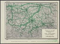
Creator:
Published / Created:
1944
Call Number:
36gme 1944A
Container / Volume:
BRBL_00132
Image Count:
1
Resource Type:
Maps, Atlases & Globes
Description:
"No. A-3051, 30 Jan. 1944." and Relief shown by spot heights.
Publisher:
lithographed in the Reproduction Branch, OSS,
Subject (Topic):
Railroads--Germany--Maps
Found in:
Beinecke Rare Book and Manuscript Library > Average daily movement of passenger trains on the German National Railroad of central Germany.
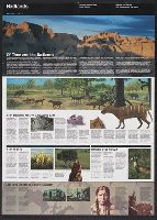
Creator:
Published / Created:
[2001]
Call Number:
823 B14 2001
Container / Volume:
BRBL_00568
Image Count:
2
Resource Type:
Maps, Atlases & Globes
Alternative Title:
Badlands and Badlands, official map and guide
Description:
"*GPO: 2001--472-470/00404. Reprint 2001.", Includes text, area map, and map of the Cedar Pass area., Relief shown by shading., and Text and col. ill. on verso.
Publisher:
The Service,
Subject (Geographic):
Badlands National Park (S.D.)--Maps
Found in:
Beinecke Rare Book and Manuscript Library > Badlands National Park, South Dakota / National Park Service, U.S. Department of the Interior.
Creator:
Published / Created:
1880
Call Number:
75AK 1880
Container / Volume:
BRBL_00407A
Image Count:
1
Resource Type:
Maps, Atlases & Globes
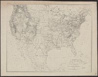
Publisher:
U.S. Coast and Geodetic Survey,
Subject (Geographic):
United States--Maps
Found in:
Beinecke Rare Book and Manuscript Library > Base-map of the United States / Drawn and engraved by A. and H. Lindenkohl.
Creator:
Published / Created:
1943
Call Number:
335gme 1943
Container / Volume:
BRBL_00087
Image Count:
1
Resource Type:
Maps, Atlases & Globes
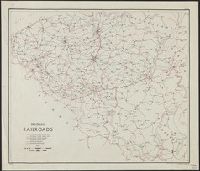
Description:
In lower left margin: Map No. 2168, 3 March 1943. and Shows 6 different categories of rail lines.
Publisher:
O.S.S. Repro. Section,
Subject (Topic):
Railroads--Belgium--Maps
Found in:
Beinecke Rare Book and Manuscript Library > Belgium, railroads / compiled and drawn in the Branch of Research and Analysis, OSS.
Creator:
Published / Created:
1943
Call Number:
335gme 1943
Container / Volume:
BRBL_00087
Image Count:
1
Resource Type:
Maps, Atlases & Globes
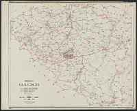
Description:
In lower left margin: Map No. 2168, 3 March 1943. and Shows 6 different categories of rail lines.
Publisher:
O.S.S. Repro. Section,
Subject (Topic):
Railroads--Belgium--Maps
Found in:
Beinecke Rare Book and Manuscript Library > Belgium, railroads / compiled and drawn in the Branch of Research and Analysis, OSS.
Branch:v1.61.8 ,Deployed:2024-06-20T11:15:15-04:00