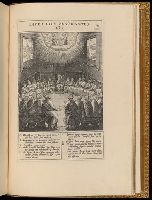
Beinecke copy : the text v. is marked as v. 1, the plates as v. 2., Beinecke copy imperfect: fourth leaf (blank) and last leaf (blank) wanting., T.p. engraved., The statement of responsibility appears after the edition statement., Plates in accompanying v. engraved by Antonie, Jeronimus and Jan Wierix, Adriaen and Jan Collaert and Carel van Mallery, mostly after designs by Bernardino Passeri and Maerten de Vos., Edited by Jacobus Ximenes., The register lists the prelim. gathering as having six leaves., Signatures: [dagger]⁴ A-2A⁶, ²2A-2G⁶ ²2H⁴., and Accompanied by: Euangelicae historiae imagines : exordine Euangeliorum, quae toto anno in Missae sacrificio recitantur ... / auctore Hieronymo Natali ... Antuerpiae ... M.D.XCIII ([10] p., 153 leaves of plates : 153 ill. ; 33 cm. (fol.)). The plates have a second series of numbers corresponding to their place in the text.
"9"--Manuscript note in upper right corner of sheet. Accompanied by: Title page: A complete body of ancient geography by Mons. D'Anville ... London : James Whittle and Richard Holmes Laurie, 1818 (1 sheet)., Includes index., Includes six bar scales., Prime meridian: Ferro., Relief shown by hachures., and Watermark.
Publisher:
Laurie & Whittle,
Subject (Geographic):
Egypt--Administrative and political divisions--Maps. and Egypt--Maps.
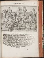
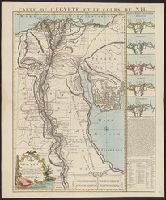
"Joannes Christophorus I.B. Homanni filius delineavit. Cum privilegio Sac. Caes. Majestatis.", Hand col. Sheet measures 65.5 x 56.5 cm., Includes illustrations of cataracts of the Nile, the pyramids, tombs, various antiquities, sce, and Relief shown by hachures.
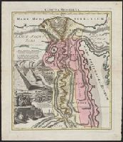
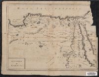
Covers region of Egypt and Sudan adjoining the Nile River., Includes decorative cartouche with ill. of coins., and Relief shown pictorially.
Publisher:
C. Weigel,
Subject (Geographic):
Egypt--Historical geography--Maps--Early works to 1800, Nile River Region--Historical geography--Maps--Early works to 1800, and Sudan--Historical geography--Maps--Early works to 1800
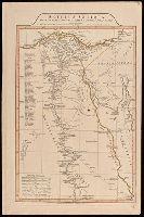
"Octavo, Vol. 2, p. 371" in lower left corner., Imperfect: upper right corner mutilated, with some loss of text. Reinforced on verso with strips of manuscript waste., Relief shown pictorially., and Shows boundaries, rivers and principal settlements.
Publisher:
[publisher not identified],
Subject (Geographic):
Egypt--Historical geography--Early works to 1800--Maps., Egypt--Maps--Early works to 1800., Libya--Historical geography--Early works to 1800--Maps., and Libya--Maps--Early works to 1800.