Skip to search
Skip to main content
Skip to first result
Search
You Searched For
Genre
Maps
Creator
U.S. Coast and Geodetic Survey
Publication Place
Washington, D.C. :
New Search
Search Results
Creator:
Published / Created:
1944
Call Number:
50 1945I
Container / Volume:
BRBL_00273
Image Count:
2
Resource Type:
Maps, Atlases & Globes
Description:
Cloth map., Includes text., Relief shown by gradient tints, contours, and spot heights., and Text in English and 6 other languages.
Publisher:
Amy Map Service,
Subject (Geographic):
Kunming Region (China)--Maps
Subject (Name):
United States. Aeronautical Chart Service, United States. Army Air Forces, and United States. Army Map Service
Subject (Topic):
Military maps
Found in:
Beinecke Rare Book and Manuscript Library > AAF cloth chart. No. 133, Kun-Ming, Yunnan, China to Chabua, Assam, India Forces / prepared under the direction of the Commanding General, Army Air Forces, for the Aeronautical Chart Service, by the U.S. Coast and Geodetic Survey, Washington, D.C., Januar
Creator:
Published / Created:
1900
Call Number:
767cea 1900
Container / Volume:
BRBL_00476
Image Count:
1
Resource Type:
Maps, Atlases & Globes
Alternative Title:
Connecticut River, Connecticut River, Deep River to Higganum, U.S.C. & G.S. (Series) ; 254., and U.S.C. & G.S. ; 254
Description:
"Date of first publication 1895.", "Electrotype copy no. 1 U.S.C. & G.S."--Upper right margin., "Soundings in feet.", Depths shown by shading and soundings., Includes tidal information., Oriented with north toward upper right corner., Plate no. 2659., and Relief sho
Publisher:
U.S. Coast and Geodetic Survey,
Subject (Geographic):
Connecticut River--Navigation
Subject (Topic):
Nautical charts--Connecticut River
Found in:
Beinecke Rare Book and Manuscript Library > Connecticut River, Deep River to Higganum, Connecticut / U.S. Coast and Geodetic Survey.
Creator:
Published / Created:
1944
Call Number:
28 Ap11 1944
Container / Volume:
BRBL_00023E
Image Count:
1
Resource Type:
Maps, Atlases & Globes
Alternative Title:
A.M.S. ; S901, Aparri, Philippine Islands, Cagayan Province, and Series (Standard map series designation system) ; S901.
Description:
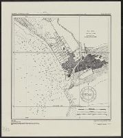
"Copied from U.S.C. & G.S. chart 4260." and Important buildings are named; soundings are given.
Publisher:
The Service,
Subject (Geographic):
Aparri (Philippines)--Maps
Found in:
Beinecke Rare Book and Manuscript Library > Philippine Islands city plans. Aparri.
Creator:
Published / Created:
1944
Call Number:
28 SA522 1944
Container / Volume:
BRBL_00024
Image Count:
1
Resource Type:
Maps, Atlases & Globes
Alternative Title:
A.M.S. ; S901, San Fernando, Philippine Islands, La Union Province, and Series (Standard map series designation system) ; S901.
Description:
"Copied from U.S.C. & G.S. chart 4246." and Depth given in soundings.
Publisher:
The Service,
Subject (Geographic):
San Fernando (La Union, Philippines)--Maps
Found in:
Beinecke Rare Book and Manuscript Library > Philippine Islands city plans. San Fernando.
Creator:
Published / Created:
1944
Call Number:
28 T11 1944
Container / Volume:
BRBL_00024
Image Count:
1
Resource Type:
Maps, Atlases & Globes
Alternative Title:
A.M.S. ; S901, Series (Standard map series designation system) ; S901., and Taal and Lemery, Philippine Islands, Batangas Province
Description:
"Copied from U.S.C. & G.S. chart 4257 ... From survey in 1905." and "Soundings in feet at mean lower low water."
Publisher:
The Service,
Subject (Geographic):
Lemery (Batangas, Philippines)--Maps and Taal (Batangas, Philippines)--Maps
Found in:
Beinecke Rare Book and Manuscript Library > Philippine Islands city plans. Taal and Lemery.
Branch:v1.61.6 ,Deployed:2024-06-12T09:55:31-04:00