Skip to search
Skip to main content
Skip to first result
Search
You Searched For
Format
cartographic
Subject (Topic)
Military maps
Subject (Name)
United States. Army Map Service
New Search
Search Results
Published / Created:
1945
Call Number:
50 1945A
Container / Volume:
BRBL_00273
Image Count:
2
Resource Type:
Maps, Atlases & Globes
Alternative Title:
AAF cloth chart.
Description:
"5/45 SS", Cloth maps., Includes sheet index., and Relief shown by gradient tints and spot heights.
Publisher:
Army Map Service,
Subject (Geographic):
Indonesia--Maps
Subject (Name):
United States. Aeronautical Chart Service and United States. Army Map Service
Subject (Topic):
Military maps
Found in:
Beinecke Rare Book and Manuscript Library > AAF cloth chart. C-800, We Island / Prepared at the direction of the Commanding General, Army Air Forces, by the Aeronautical Chart Service, Washington, D.C., from existing Aeronautical Charts, March 1945, Base No. 1.
Creator:
Published / Created:
1944
Call Number:
50 1945I
Container / Volume:
BRBL_00273
Image Count:
2
Resource Type:
Maps, Atlases & Globes
Description:
Cloth map., Includes text., Relief shown by gradient tints, contours, and spot heights., and Text in English and 6 other languages.
Publisher:
Amy Map Service,
Subject (Geographic):
Kunming Region (China)--Maps
Subject (Name):
United States. Aeronautical Chart Service, United States. Army Air Forces, and United States. Army Map Service
Subject (Topic):
Military maps
Found in:
Beinecke Rare Book and Manuscript Library > AAF cloth chart. No. 133, Kun-Ming, Yunnan, China to Chabua, Assam, India Forces / prepared under the direction of the Commanding General, Army Air Forces, for the Aeronautical Chart Service, by the U.S. Coast and Geodetic Survey, Washington, D.C., Januar
Creator:
Published / Created:
1945
Call Number:
50 1945
Container / Volume:
BRBL_00273
Image Count:
2
Resource Type:
Maps, Atlases & Globes
Alternative Title:
AAF cloth chart.
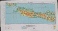
Description:
"3/45 SS" and "4/45 SS", Cloth maps., Includes sheet index, map "Index to boundaries," and "Conversion table.", and Relief shown by gradient tints and spot heights.
Publisher:
Army Map Service,
Subject (Geographic):
Indonesia--Maps
Subject (Name):
United States. Aeronautical Chart Service and United States. Army Map Service
Subject (Topic):
Military maps
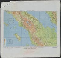
Found in:
Beinecke Rare Book and Manuscript Library > AAF cloth chart. No. C-48 West Java / reproduced under the direction of the Commanding General, Army Air Forces for the Aeronautical Chart Service by the Army Map Service, Washington D.C. ; copied by Lake Survey Branch, A.M.S., Detroit, Michigan, July 194
Creator:
Published / Created:
1944
Call Number:
50 1945M
Container / Volume:
BRBL_00273
Image Count:
1
Resource Type:
Maps, Atlases & Globes
Alternative Title:
Eastern Asia, Kagoshima., and Nagasaki.
Description:
"A.M.S. 5301.", Cloth map (silk)., For further information see a Web site devoted to the history and identification of the AAF cloth maps., Heights and depths in meters., Includes: Index to boundarie, and Relief shown by gradient tints, contours, and spot heights.
Publisher:
Amy Map Service,
Subject (Geographic):
East Asia--Maps
Subject (Name):
United States. Army Map Service
Subject (Topic):
Military geography--Japan--Kagoshima--Maps, Military geography--Japan--Nagasaki--Maps, Military maps, Military topography--Japan--Kagoshima--Maps, and Military topography--Japan--Nagasaki--Maps
Found in:
Beinecke Rare Book and Manuscript Library > [AAF cloth chart]. Eastern Asia [cartographic material].
Branch:v1.61.8 ,Deployed:2024-06-20T11:14:55-04:00