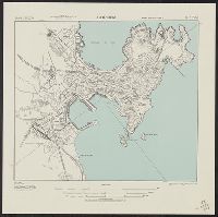
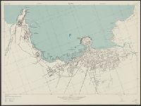
"Copied from I. S. I. S. report, 1:2,400, La Coruna, CB 1811, no. 12, 1942.", At head of title: Spain 1:10,000., and Some streets and buildings are named.
A.M.S. ; 6201 and Series (Standard map series designation system) ; 6201.
Description:
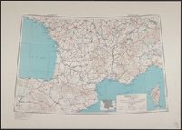
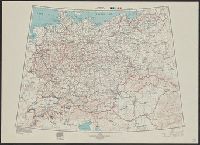
"Lambert conformal conic projection.", Elevations shown by hachures and spot heights in meters., France (north) 1st ed.-AMS 1.--France (south) 1st ed.-AMS 2., Insets show area with detailed transportation information., North sheet without series note., and Two cla
"Lambert conical orthomorphic projection.", Elevations are shown by hachures and spot heights in meters., Marginal map shows area with detailed transportation information., and Two classes of roads and five classes of railroads are shown.
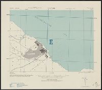
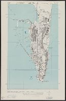
"Copied from British Admiralty chart no. 144, corrected to 1942. Revised in part from R. A. F. aerial photographs.", In upper margin: Spain ... City plan., Military grid., Relief shown by hachures., and Some buildings and other features are named.
"Copied from British Admiralty chart no. 144, corrected to 1942. Revised in part from R. A. F. aerial photographs.", In upper margin: Spain ... City plan., Military grid., Relief shown by hachures., and Some buildings and other features are named.
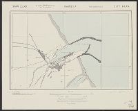
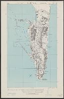
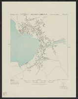
"Copied from I. S. I. S. report, 1:7,660, Gijon & Musel, CB 1811, no. 9, 1942.", At head of title: Spain 1:10.000., Military grid., and Some streets and buildings are named.