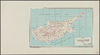
"11-47.", "5207.", "Polyconic projection.", Elevations are shown by hachures and spot heights in feet., Previous issue included in series AMS 6201., and Principal roads and railroads are shown.
Its A.M.S. ; 5207 and Series (Standard map series designation system) ; 5207.
Description:
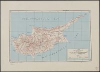
"Polyconic projection.", Elevations are shown by hachures and spot heights in meters., and Two classes of roads, and three classes of railroads are shown.
Its A.M.S. ; L991 and Series (Standard map series designation system) ; L991.
Description:
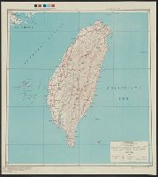
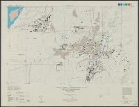
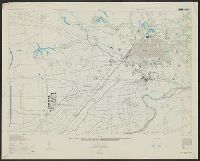
"Contour interval 10 meters, with auxiliary contours at 5 meter intervals.", "Place names are transcribed according to the modified Hepburn (Romaji) system.", "Polyconic projection.", At head of title: Formosa city plans ..., Includes "Glossary.", and Marginal map
Its A.M.S. ; L991 and Series (Standard map series designation system) ; L991.
Description:
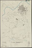
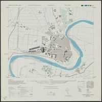
"Contour interval 20 meters, auxiliary contours at 10 meter intervals.", "Place names are transcribed according to the modified Hepburn (Romaji) system.", "Polyconic projection.", At head of title: Formosa city plans ..., Includes "Glossary.", and Marginal maps an
Its A.M.S. ; L991 and Series (Standard map series designation system) ; L991.
Description:
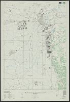
"Place names are transcribed according to the modified Hepburn (Romaji) system.", "Polyconic projection.", At head of title: Formosa city plans ..., Classified roads and trails, railroads, and areas of vegetation and cultivation are shown., and Includes "Glossary
Its A.M.S. ; L991 and Series (Standard map series designation system) ; L991.
Description:
"Contour interval 10 meters.", "Place names are transcribed according to the modified Hepburn (Romaji) system.", "Polyconic projection.", At head of title: Formosa city plans ..., Includes "Glossary.", and Marginal maps and diagrams: Index to boundaries.--Coverage
Its A.M.S. ; 5207 and Series (Standard map series designation system) ; 5207.
Description:
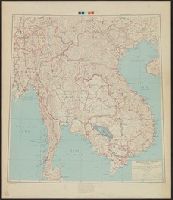
"5-45.", "Lambert conformal conic projection.", Elevations are shown by hachures and spot heights in meters., and Two classes of roads and double and single track railroads are shown.
Publisher:
Army Map Service,
Subject (Geographic):
Southeast Asia--Maps and Thailand--Maps
Subject (Topic):
Transportation--Southeast Asia--Maps and Transportation--Thailand--Maps
Its A.M.S. ; L991 and Series (Standard map series designation system) ; L991.
Description:
"Contour interval 10 meters, with auxiliary contours at 5 meter intervals.", "Place names are transcribed according to the modified Hepburn (Romaji) system.", "Polyconic projection.", In upper margin: Formosa city plans ..., Includes "Glossary.", and Marginal maps