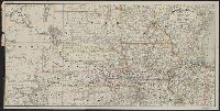
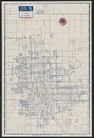
Covers area from Colorado to Lake Michigan, through South Dakota, Minnesota, Wisconsin, Nebraska, Iowa, Illinois, and northern Kansas and Missouri. and Relief shown by hachures.
Publisher:
Rand McNally & Co.,
Subject (Name):
Chicago, Burlington & Quincy Railroad Company and Chicago, Burlington & Quincy Railroad Company--Maps
Subject (Topic):
Railroads--Middle West--Maps and Railroads--West (U.S.)--Maps
"Engraved and indexed for use with the Rand McNally commercial atlas and marketing guide.", Date inferred from 1950 population table of counties., and Indexed.
Publisher:
The Company,
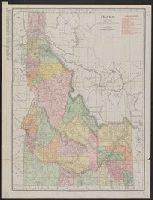
Subject (Geographic):
Colorado--Administrative and political divisions--Maps and Colorado--Maps
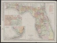
Rand, McNally & Co.'s New business atlas map of Florida
Description:
Includes table for identifying marked Florida railroads., Insets: Map showing part of Lake, Orange & Volusia Counties. [Scale ca. 1:321,870] -- Southern portion of Florida. [Scale ca. 1:1,203,840]., Prime meridian: Greenwich., and Relief shown by hachures.
In lower right: 534506. and Includes indexes, and maps of "Kings Canyon and Sequoia national parks," "Yosemite National Park," and "Fresno, Stockton, Yosemite, Kings Canyon, and Sequoia Region, Calif.," and ill. on verso.
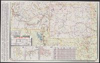
"0-5648-6.", At head of title: Sinclair., Includes indexes, ill., insets of "Waterton-Glacier International Peace Park, Alta.-Mont." and "Yellowstone and Grant Teton national parks, Wyo.," distance table, 3 local route maps, and text., and Relief shown pictorial
Publisher:
Rand McNally,
Subject (Geographic):
Idaho--Maps, Montana--Maps, and Wyoming--Maps
Subject (Name):
Sinclair Oil Corporation
Subject (Topic):
Roads--Idaho--Maps, Roads--Montana--Maps, and Roads--Wyoming--Maps
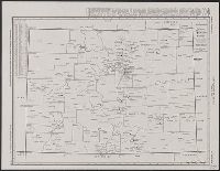
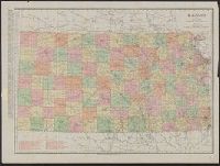
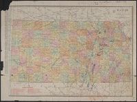
Rand-McNally indexed pocket map and shippers' guide of Kansas
Description:
"Showing all railroads, cities, towns, villages, postoffices, lakes, rivers, etc."--Cover of text., Indexed., Library's copy missing text., Relief shown by hachures., and Shows railroads, military reservations, postal and express services.
Below scale: Rand McNally & Co.'s new business atlas map of Kansas. Copyright 1911 ... Copyright 1903 ...., Imperfect. Chipped with some loss of text: Ms. annotations to indicate oil fields and drilling., Indexed on verso., Indexed., Relief shown by hachures., and Shows counties and railroads.