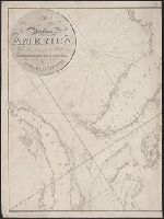
From The English pilot, The Fourth book. Dublin, Geo. Grierson, 1749 and later and perhaps earlier editions. Copied from the London wdition. and Inset: "A Large Draught of Ashly and Coopers River."
Subject (Geographic):
North Carolina--Maps--Early works to 1800 and South Carolina--Maps--Early works to 1800
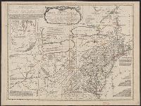
Differs from other copies in absence of Connecticut River north of "Great Falls." Also differs in coloration of boundaries: Ohio and Kentucky Rivers are colored as boundaries; Pennsylvania extends north to a line at approximately 42⁰ 40ʹ; Maryland extends
[American maps ; v. 3, no. 22], Canada from the French surveys with the frontiers of New York and New England., and Library of Congress. American maps ; v. 3, no. 22.
Description:
Relief shown pictorially and by hachures. and Shows the Canadian-United States border from Lake Ontario along the St. Lawrence River to 45₋p0₋s N. latitude, east to the Connecticut River, and northeast along the "Height of the land." Coverage of areas away fr
Subject (Geographic):
Canada--Boundaries--United States--Maps--Early works to 1800, New York (State)--Maps--Early works to 1800, Québec (Province)--Maps--Early works to 1800, and United States--History--Revolution, 1775-1783--British forces
A plan of the cities of London and Westminster, and borough of Southwark.
Description:
"Emery Walker Ltd. Collotypers.", Accompanied by index map, receipt slips, and publisher's note. 5 l., Accompanied by: London Topographical Society, E, Alternate title: Rocque's map of London, 1746., Facsimile., and Relief shown by hachures and land form drawings.
Publisher:
John Pine & John Tinney, and London Topographical Society,
Subject (Geographic):
London (England)--Maps--Early works to 1800--Facsimiles, Southwark (London, England)--Maps--Early works to 1800--Facsimiles, and Westminster (London, England)--Maps--Early works to 1800--Facsimiles
Subject (Name):
London Topographical Society, Pine, John, 1690-1756, and Tinney, John