[Atlas factice of 96 maps by Blaeu, Visscher, Jansson, Hondius and others]
Image Count:
2
Description:
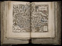
A set of 9 maps (no. IIII-XII) are from the Stumpf-Chronik., Hand col. Sheet measures 38.8 x 50 cm. Ms. notes in 19th century hand at bottom. Reinforced along edges with manuscript waste. No. 45 of 92 maps bound together., and Numbered 49 on verso.
Publisher:
[Christoffel Froschauer]
Subject (Geographic):
Germany, Southern --Maps --Early works to 1800 and Switzerland --Maps --Early works to 1800