Skip to search
Skip to main content
Skip to first result
Search
You Searched For
Language
Latin
New Search
Search Results
Creator:
Published / Created:
1552?]
Call Number:
13 1552
Container / Volume:
BRBL_00011
Image Count:
2
Resource Type:
Maps, Atlases & Globes
Found in:
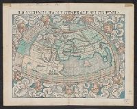
Beinecke Rare Book and Manuscript Library > La seconde table generale selon Ptol[omée].
Creator:
Published / Created:
1756?]
Call Number:
352 L126 1756
Container / Volume:
BRBL_00107
Image Count:
1
Resource Type:
Maps, Atlases & Globes
Found in:
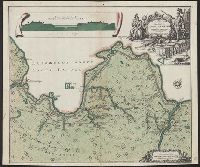
Beinecke Rare Book and Manuscript Library > Ladozhskoĭ kanal = Canalis Ladogensis : nova delineatio secundum exemplar Petropolitanum / aeri incidit Matthaeus Seutter, sac. Caes. maj. geogr.
Creator:
Published / Created:
[between 1601 and 1605]
Call Number:
Beinecke MS 536
Image Count:
86
Resource Type:
unspecified
Found in:
Beinecke Rare Book and Manuscript Library > Lamentationes Ieremiae carmine elegiaco redditae
Published / Created:
1893
Call Number:
3235 1662
Container / Volume:
BRBL_00064
Image Count:
1
Resource Type:
Maps, Atlases & Globes
Found in:
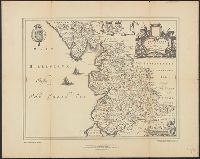
Beinecke Rare Book and Manuscript Library > Lancastria ... 1662.
Published / Created:
approximately 1200-1225.
Call Number:
Beinecke MS 712.10
Image Count:
2
Resource Type:
text
Found in:
Beinecke Rare Book and Manuscript Library > Land grant from William de Nevile to William the dyer of Almondbury
Creator:
Published / Created:
[1742]
Call Number:
1977 Folio 177
Image Count:
2
Resource Type:
Maps, Atlases & Globes
Found in:
Beinecke Rare Book and Manuscript Library > Land-Charte des Chur-Fürstenthums Brandenburg [cartographic material].
Creator:
Published / Created:
[1738]
Call Number:
1973 Folio 30
Collection Title:
[Atlas factice of 32 maps and 1 distance table, produced by the Homann Erben firm]
Image Count:
2
Found in:
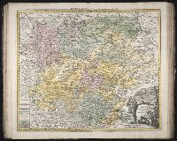
Beinecke Rare Book and Manuscript Library > Landgraviat Thuringiae tabula generalis in suos principatus et status accurate divi / [cartographic material] / per Ioh. Bapt. Homa[nn]
Published / Created:
[1710?]
Call Number:
38345 1710
Container / Volume:
BRBL_00178
Image Count:
1
Resource Type:
Maps, Atlases & Globes
Found in:
Beinecke Rare Book and Manuscript Library > Landgravitus Alsatiae ... Marchionatu Badensi ...
Published / Created:
[1700?]
Call Number:
38 L26 1700
Container / Volume:
BRBL_00157
Image Count:
2
Resource Type:
Maps, Atlases & Globes
Found in:
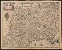
Beinecke Rare Book and Manuscript Library > Langredoc.
Creator:
Published / Created:
[163-?]
Call Number:
1973 Folio 18
Image Count:
1
Resource Type:
Maps, Atlases & Globes
Found in:
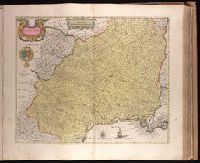
Beinecke Rare Book and Manuscript Library > Languedoc [cartographic material].
Branch:v1.60.98 ,Deployed:2024-05-29T09:42:50-04:00