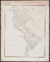
Abtheilung V. Übersichtskarte der americanischen Staaten
Description:
At head of title: Abtheilung V., In lower right margin: Lith. u. gedr. im geogr. lith. Institut v. Albr. Platt., In upper right margin: Platt's grosser Atlas der Erde No. 57., and Relief shown by hachures.
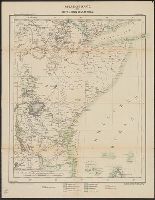
Deutsche Kolonialkarten nr. 7. and Übersichtskarte des mittleren Ostafrika
Description:
"Deutsche Kolonialkarten nr. 7"--in upper left hand corner., "Korrigierter Ausschnitt aus Kettler-Mèuller's Wandkarte von Afrika in 4 Bl., Preis 10 M"--in lower right hand corner., Title from panel., and Verso includes list of publications and map of Tanzania.
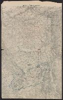
"Druck der Vermess. Abt. 2"., Legend indicates voltage, power lines, transformer stations, power switching stations, front line., Ms. annotations in German. Imperfect: cut around borders., and On verso: Ms. notes: "Komp.-Karte".
Publisher:
s.n.,]
Subject (Geographic):
Lorraine (France)--Maps
Subject (Topic):
Electric lines, World War, 1914-1918--France--Lorraine, and World War, 1914-1918--Maps
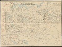
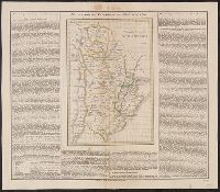
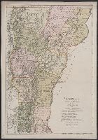
"Zu Ebelings Erdbeschr, Also shows county boundaries., In upper right margin: No. XVI., Place names in German and English., Prime meridians: Greenwich and Washington., Relief shown by hachures., and Sheet measures 72.4 x 50.5 cm. Franklin Collection no. 131 1796 1.
Publisher:
Bey Carl Ernst Bohn,
Subject (Geographic):
Vermont--Administrative and political divisions--Maps--Early works to 1800 and Vermont--Maps--Early works to 1800
Subject (Name):
Bohn, Carl Ernst, publisher, Ebeling, Christophe Daniel, 1741-1817. Erdbeschreibung und Geschichte von Amerika, and Schmidt, Paulus, engraver