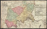
"Joannes Christophorus I.B. Homanni filius delineavit. Cum privilegio Sac. Caes. Majestatis.", Hand col. Sheet measures 65.5 x 56.5 cm., Includes illustrations of cataracts of the Nile, the pyramids, tombs, various antiquities, sce, and Relief shown by hachures.
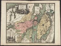
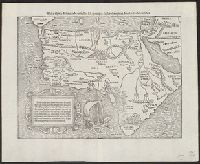
German title and text, Latin place names., Includes text and ill., Relief shown pictorially., Sheet measures 34 x 42 cm., and Text in ornamental frame on verso: Des gantzen Landts Africe, ein gemeine beschreibung. xxv.
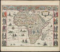
"Cum privilegio ad decennium.", Appears in C. and J. Blaeu's Novus atlas of 1641-1642, J. Blaeu's Novus atlas of, Includes col. ill. of ships, monsters, etc., and of African peoples and 9 city views in border., Signature on verso: A., and Title on verso: Africa.
On verso: "Karte des Deutchen Reiches 1:100 000, Groβblatt 66", overstruck by black "X"., Relief shown by form lines, shading and spot heights. Depths shown on some sheets by shading., and Sheets individually subtitled with place name.
Publisher:
OKH/Gen St d H,
Subject (Geographic):
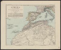
Algeria--Maps
Subject (Name):
Germany. Heer. Abteilung für Kriegskarten- und Vermessungswesen
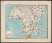
Adolf Stieler's Hand Atlas über alle Theile der Eund über das Weltgebäude. and Afrika im Massstab von 1:25.000.000
Description:
"Stieler's Hand Atlas, no. 68.", Appears in Adolf Stieler's Hand Atlas über alle Theile der Erde und über das Weltgebäude. 1881., In bottom margin: X IX., and Relief shown by hachures and spot heights.
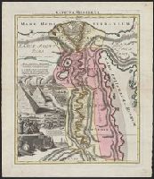
Adolf Stieler's Hand Atlas über alle Theile der Erde un über das Weltgebäude., Afrika in sechs Blättern, and Südafrika, Capland, und angrenzende Gebiete, im Massstab von 1:5.000.000.
Description:
Appears in Adolf Stieler's Hand Atlas über alle Theile der Erde und über das Weltgebäude. 1891., In top margin of each sheet, followed by consecutive numbering "no. 66" through "no. 71": Stieler's Hand Atlas., Relief shown by hachures and spot heights., and S