Skip to search
Skip to main content
Skip to first result
Search
You Searched For
Format
cartographic
Publication Place
[London] :
New Search
Search Results
Creator:
Published / Created:
1913
Call Number:
6551 1913
Container / Volume:
BRBL_00346
Image Count:
1
Resource Type:
Maps, Atlases & Globes
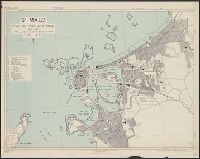
Alternative Title:
Geographical Journal.
Description:
"Note. This map is taken from the G.S.G.S. map of Northern and SOuthern Nigeria, scale 1:2,000,000, with additions by Mr. A.E. Kitson.", "Southern Nigeria, Kitsun" in lower right corner., "The Geographical Journal, 1913" in upper right corner., and Includes insets of Lagos and titular map on larger scale map.
Publisher:
Royal Geographical Society,
Subject (Geographic):
Nigeria, Southern--Maps
Found in:
Beinecke Rare Book and Manuscript Library > Southern Nigeria : to illustrate the paper by A.E. Kitson.
Creator:
Published / Created:
1918
Call Number:
186 1918
Container / Volume:
BRBL_00013
Image Count:
1
Resource Type:
Maps, Atlases & Globes
Description:
"Ordnance Survey, August, 1918." and Insets: [1.] Bear Island. Scale 1:1,000,000 -- [2. Map of northern Europe.] Scale 1:35,000,000.
Publisher:
[GSGS, War Office],
Subject (Geographic):
Svalbard (Norway)--Maps
Found in:
Beinecke Rare Book and Manuscript Library > Spitsbergen, GSGS 2877.
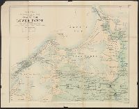
Published / Created:
1908
Call Number:
186 P93 1908
Container / Volume:
BRBL_00013
Image Count:
1
Resource Type:
Maps, Atlases & Globes
Alternative Title:
Geographical journal.
Description:
Includes location map. and Published in v. 32, no. 2, August 1908 issue of the Geographical Journal, accompanying article titled "The Exploration of Prince Charles Foreland, 1906-1907" by William S. Bruce.
Publisher:
Royal Geographical Society,
Subject (Geographic):
Spitsbergen Island (Norway)--Discovery and exploration--Maps
Subject (Name):
Bruce, William S. (William Speirs), 1867-1921
Found in:
Beinecke Rare Book and Manuscript Library > Spitsbergen, preliminary map of Prince Charles foreland, from surveys by W. S. Bruce, 1906-7.
Creator:
Published / Created:
1943, 1944 printing.
Call Number:
38 Sa233 1944
Container / Volume:
BRBL_00165
Image Count:
1
Resource Type:
Maps, Atlases & Globes
Alternative Title:
France 1:6,000, Geographical Section, General Staff ; no. 4234, GSGS (Series) ; 4234., Saint Malo, and St. Malo, plan of port and town
Description:
"G.S.G.S. edition, 1943.", "Grid provisional. Lambert zone I grid.", "I-44.", "War Office, 1943.", Principal street names, important buildings and port facilities are indicated., Relief shown by rock drawings., and Street names and some places of interest in French
Publisher:
Army Map Service, U.S. Army, and War Office ;
Subject (Geographic):
Saint-Malo (France)--Maps
Found in:
Beinecke Rare Book and Manuscript Library > St. Malo [cartographic material] : plan of port and town / compiled and drawn by Inter-Service Topographical Dept. ; produced under the Superintendence of Vice-Admiral John Edgell, hydrographer.
Creator:
Published / Created:
1882
Call Number:
611 1882
Container / Volume:
BRBL_00331
Image Count:
2
Resource Type:
Maps, Atlases & Globes
Alternative Title:
Map of the seat of war in Lower Egypt
Description:
Relief shown by hachures. and Shows: railways, roads, towns.
Publisher:
Edward Stanford,
Subject (Geographic):
Alexandria (Egypt)--History--Bombardment, 1882 and Egypt--Maps
Found in:
Beinecke Rare Book and Manuscript Library > Stanford's large scale map of the seat of war in Lower Egypt.
Published / Created:
1823
Call Number:
5856cea 1823
Container / Volume:
BRBL_00315
Image Count:
2
Resource Type:
Maps, Atlases & Globes
Description:
Descriptive notes.
Publisher:
James Horsburgh,
Subject (Geographic):
Malacca, (Malacca)--Maps
Found in:
Beinecke Rare Book and Manuscript Library > Strait of Malacca. Sheet II. J. Walker sculpt.
Published / Created:
1823
Call Number:
5856cea 1823
Container / Volume:
BRBL_00315
Image Count:
1
Resource Type:
Maps, Atlases & Globes
Description:
Descriptive notes.
Publisher:
James Horsburgh,
Subject (Geographic):
Malacca, (Malacca)--Maps
Found in:
Beinecke Rare Book and Manuscript Library > Strait of Malacca. Sheet II. J. Walker sculpt.
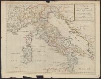
Creator:
Published / Created:
[between 1715 and 1720?]
Call Number:
400 1715A
Container / Volume:
BRBL_00232
Image Count:
1
Resource Type:
Maps, Atlases & Globes
Description:
Relief shown pictorially.
Publisher:
Sold by I. Senex at the globe over against St. Dunstan's Church in Fleetstreet ... ,
Subject (Geographic):
Italy--Historical geography--Maps--Early works to 1800, Italy--History--To 476--Maps--Early works to 1800, and Rome--Maps--Early works to 1800
Subject (Name):
Senex, John, d. 1740
Found in:
Beinecke Rare Book and Manuscript Library > Tabula Italiae antiquae in regiones XI ad Augusto divisiae et tum ad mensuras itineraris tum ad observationes astronomicas exactae / accurante Guillelmo Del'isle ... ; Joan. Bap. Liébaux sculpsit.
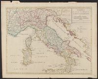
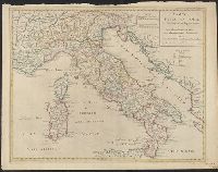
Branch:v1.61.8 ,Deployed:2024-06-20T11:15:04-04:00