Skip to search
Skip to main content
Skip to first result
Search
You Searched For
Format
cartographic
Publication Place
[London] :
New Search
Search Results
Published / Created:
[1914?]
Call Number:
488 1914
Container / Volume:
BRBL_00266
Image Count:
1
Resource Type:
Maps, Atlases & Globes
Description:
G.S.G.S. 3694.
Publisher:
G.S.G.S.,
Subject (Geographic):
Aegean Sea--Maps
Found in:
Beinecke Rare Book and Manuscript Library > The Aegean Sea.
Published / Created:
[1914?]
Call Number:
488 1914
Container / Volume:
BRBL_00266
Image Count:
1
Resource Type:
Maps, Atlases & Globes
Description:
G.S.G.S. 3694.
Publisher:
G.S.G.S.,
Subject (Geographic):
Aegean Sea--Maps
Found in:
Beinecke Rare Book and Manuscript Library > The Aegean Sea.
Creator:
Published / Created:
1928
Call Number:
615 1928
Container / Volume:
BRBL_00332
Image Count:
1
Resource Type:
Maps, Atlases & Globes
Alternative Title:
Geographical Section General Staff ; 2692 and GSGS (Series) ; 2692.
Description:
Relief shown by shading. and Shows: international and administrative boundaries, railways, roads, marsh.
Publisher:
G.S.G.S.,
Subject (Geographic):
Sudan--Maps
Found in:
Beinecke Rare Book and Manuscript Library > The Anglo-Egyptian Sudan [cartographic material].
Published / Created:
1916
Call Number:
44 1916
Container / Volume:
BRBL_00256
Image Count:
1
Resource Type:
Maps, Atlases & Globes
Description:
"Supplement to the National Review, October 1916."
Publisher:
George Philip & Son, Ltd.,
Subject (Geographic):
Balkan Peninsula--Maps
Found in:
Beinecke Rare Book and Manuscript Library > The Balkan States and part of Austria-Hungary.
Published / Created:
[1756?]
Call Number:
755 1756C
Container / Volume:
BRBL_00428
Image Count:
1
Resource Type:
Maps, Atlases & Globes
Publisher:
Printed for T. Bowles ... & Iohn Bowles & Son ... ,
Subject (Geographic):
North America--Maps--Early works to 1800 and United States--History--French and Indian War, 1755-1763--Maps--Early works to 1800
Subject (Topic):
British--North America--Maps--Early works to 1800 and French--North America--Maps--Early works to 1800
Found in:
Beinecke Rare Book and Manuscript Library > The British & French dominions in North America : particularly shewing the French encroachments through all the British plantations from Nova Scotia down to the Gulf of Mexico.
Published / Created:
1790
Call Number:
33 1790
Container / Volume:
BRBL_00077
Image Count:
1
Resource Type:
Maps, Atlases & Globes
Publisher:
T. Stackhouse,
Subject (Geographic):
Netherlands--Maps--Early works to 1800
Found in:
Beinecke Rare Book and Manuscript Library > The Catholic Netherlands with the seven united provinces / engraved by S.J. Neele.
Published / Created:
1910
Call Number:
533ex 1910
Container / Volume:
BRBL_00288
Image Count:
1
Resource Type:
Maps, Atlases & Globes
Description:
"The geographical journal, 1910.", Includes inset location map and inset "Plan of the mounds of Munbaya.", and Relief shown by hachures.
Publisher:
Royal Geographical Society,
Subject (Geographic):
Euphrates River Valley--Discovery and exploration--Maps
Subject (Name):
Bell, Gertrude Lowthian,--1868-1926--Travel--Maps and Royal Geographical Society (Great Britain)
Found in:
Beinecke Rare Book and Manuscript Library > The Euphrates from Jerablus to Hit [cartographic material] : showing the route of Miss Gertrude Lowthian Bell along the eastern bank.
Creator:
Published / Created:
1861
Call Number:
7345cea 1861
Container / Volume:
BRBL_00381
Image Count:
1
Resource Type:
Maps, Atlases & Globes
Alternative Title:
From Pashasheeboo Pt. to Magpie Bay and Pashasheeboo Pt. to Magpie Bay
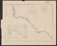
Description:
"J. & C. Walker, Sculpt.", "Large corrections 1861.", "Published according to Act of Parliament at the Hydrographical Office of the Admiralty, Decr. 1st. 1837.", In lower left margin: "1279", in lower right margin: "306.", and Relief shown by hachures and spot he
Publisher:
Hydrographical Office of the Admiralty,
Subject (Geographic):
Saint Lawrence, Gulf of--Navigation
Subject (Name):
Great Britain. Hydrographic Office and J. & C. Walker (Firm)
Subject (Topic):
Nautical charts--Saint Lawrence, Gulf of
Found in:
Beinecke Rare Book and Manuscript Library > The Gulf of St. Lawrence. Sheet IV, From Pashasheeboo Pt. to Magpie Bay / surveyed by Captn. H.W. Bayfield, 1832-1834.
Creator:
Published / Created:
1894
Call Number:
592 1894
Container / Volume:
BRBL_00319
Image Count:
2
Resource Type:
Maps, Atlases & Globes
Alternative Title:
Karakoram Himalayas Sheet I Bagrot, Hunza, Nagyr & the Hispar Glacier and Karakoram Himalayas Sheet II The Biafo & Baltoro Glaciers
Description:
Imperfect: both sheets mutilated. Stamped "Connecticut Academy of Arts and Scienses, New Haven, Conn. U.S.A.", Relief shown by shading and spot heights., and The Karakoram Himalayas Sheet I Bagrot, Hunza, Nagyr & the Hispar Glacier -- The Karakoram Himalayas Sh
Publisher:
Royal Geographical Society,
Subject (Geographic):
Karakoram Range--Maps
Subject (Name):
Conway, William Martin, Sir, 1856-1937
Found in:
Beinecke Rare Book and Manuscript Library > The Karakoram Himalayas / surveyed in 1892 by W. Martin Conway, & reduced from his drawings ; published by the Royal Geographical Society.
Creator:
Published / Created:
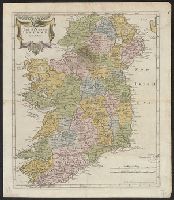
[1680?]
Call Number:
327 1680
Container / Volume:
BRBL_00072
Image Count:
1
Resource Type:
Maps, Atlases & Globes
Publisher:
Sold by Abel Swale Awnsham and John Churchill,
Subject (Geographic):
Ireland--Maps--Early works to 1800
Found in:
Beinecke Rare Book and Manuscript Library > The Kingdom of Ireland / by Robt. Morden.
Branch:v1.61.8 ,Deployed:2024-06-20T11:15:15-04:00