Search
You Searched For
Search Results
- Published / Created:
- 1859
- Call Number:
- 401 1859
- Container / Volume:
- BRBL_00233
- Image Count:
- 1
- Resource Type:
- Maps, Atlases & Globes
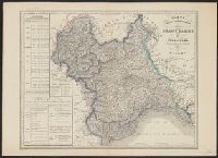
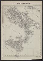
- Description:
- In upper margin: Atlante geografico dell'Italia.
- Publisher:
- Vallardi,
- Subject (Geographic):
- France--Maps and Italy--Maps
- Found in:
- Beinecke Rare Book and Manuscript Library > Carta politico-amministativa degli State Sarde di Terraferma / V. Stanghi e G. Maina Inc. ; G Pozzi scrisse.
- Published / Created:
- 1857
- Call Number:
- 40 1857
- Container / Volume:
- BRBL_00200
- Image Count:
- 1
- Resource Type:
- Maps, Atlases & Globes
- Publisher:
- Presso Ferd. Artaria e Figlio, editori,
- Subject (Geographic):
- Italy--Maps
- Found in:
- Beinecke Rare Book and Manuscript Library > Carta stradale dell' Italia : disegnata ed incisa dietro le carte piu recenti ed accreditate / da Pietro Allodi ; Giberto Morandotti impr.
- Published / Created:
- 1848
- Call Number:
- 40hc 1848
- Container / Volume:
- BRBL_00231
- Image Count:
- 1
- Resource Type:
- Maps, Atlases & Globes
- Publisher:
- Presso la libreria d'Istruzione da Andrea Ubicini,
- Subject (Geographic):
- Italy--Maps
- Found in:
- Beinecke Rare Book and Manuscript Library > Carta topografica della guerra dell'Anno 1848.
- Published / Created:
- [ca. 1864]
- Call Number:
- 40hc 1864
- Container / Volume:
- BRBL_00231
- Image Count:
- 1
- Resource Type:
- Maps, Atlases & Globes
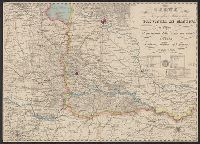
- Description:
- 4 inset maps: [1.] Legnago -- [2.] Peschiera -- [3.] Verona -- [4.] Mantova.
- Publisher:
- Presso la libreria d'Educazione e d'Istruzione da Andrea Ubicini,
- Subject (Geographic):
- Italy, Northern--Maps
- Found in:
- Beinecke Rare Book and Manuscript Library > Carta topografica della guerra.
- Published / Created:
- 1866
- Call Number:
- 40 M313 1859A
- Container / Volume:
- BRBL_00210
- Image Count:
- 1
- Resource Type:
- Maps, Atlases & Globes
- Publisher:
- Cesare Crivelli,
- Subject (Geographic):
- Mantua (Italy : Province)--Maps
- Found in:
- Beinecke Rare Book and Manuscript Library > Carta topografica militare della Provincia di Mantova : il perimetro dello stato suo attuale l'ultima rettifica del giorno 18 Mag. 1866.
- Published / Created:
- 1859
- Call Number:
- 40 M313 1859
- Container / Volume:
- BRBL_00210
- Image Count:
- 1
- Resource Type:
- Maps, Atlases & Globes
- Publisher:
- Cesare Crivelli,
- Subject (Geographic):
- Mantua (Italy : Province)--Maps
- Found in:
- Beinecke Rare Book and Manuscript Library > Carta topografica militare della Provincia di Mantova : il perimetro dello stato suo attuale l'ultima rettifica del giorno 28 Mag. 1859.
- Published / Created:
- [1800]
- Call Number:
- 408 1800A
- Container / Volume:
- BRBL_00238
- Image Count:
- 1
- Resource Type:
- Maps, Atlases & Globes
- Publisher:
- Lit. Bertotti,
- Subject (Geographic):
- Kingdom of the Two Sicilies--Maps, Naples (Kingdom)--Maps, and Sicily (Italy)--Maps
- Found in:
- Beinecke Rare Book and Manuscript Library > Carte delle Due Sicilie.
- Published / Created:
- [1860?]
- Call Number:
- 40 AS26 1860
- Container / Volume:
- BRBL_00204
- Image Count:
- 1
- Resource Type:
- Maps, Atlases & Globes
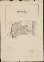
- Description:
- In upper margin: Atlante Geografico dell'Italia.
- Publisher:
- Dott. Francesco Vallardi, tipografo-editore,
- Subject (Geographic):
- Ascoli Piceno (Italy : Province)--Maps
- Found in:
- Beinecke Rare Book and Manuscript Library > Circondario d'Acoli Piceno : Provincia d'Ascoli Piceno.
- Published / Created:
- [1860?]
- Call Number:
- 40 AS26 1860
- Container / Volume:
- BRBL_00204
- Image Count:
- 1
- Resource Type:
- Maps, Atlases & Globes
- Description:
- In upper margin: Atlante Geografico dell'Italia.
- Publisher:
- Dott. Francesco Vallardi, tipografo-editore,
- Subject (Geographic):
- Ascoli Piceno (Italy : Province)--Maps
- Found in:
- Beinecke Rare Book and Manuscript Library > Circondario d'Acoli Piceno : Provincia d'Ascoli Piceno.
- Published / Created:
- [1860?]
- Call Number:
- 40 B476 1860
- Container / Volume:
- BRBL_00205
- Image Count:
- 1
- Resource Type:
- Maps, Atlases & Globes
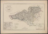
- Description:
- 2 inset maps: Biella, Ivrea. and In upper margin: Atlante Geografico dell'Italia.
- Publisher:
- Dr. Francesco Vallardi, editore,
- Subject (Geographic):
- Biella (Italy : Province)--Maps, Ivrea--Maps, Novara (Italy : Province)--Maps, and Turin (Italy : Province)--Maps
- Found in:
- Beinecke Rare Book and Manuscript Library > Circondario di Biella, Provincia di Novara, circondario di Ivrea, Provincia di Torino.