Skip to search
Skip to main content
Skip to first result
Search
You Searched For
Resource Type
Maps, Atlases & Globes
Language
English
New Search
Search Results
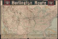
Published / Created:
c1902.
Call Number:
75gme 1915
Container / Volume:
BRBL_00414A
Image Count:
1
Resource Type:
Maps, Atlases & Globes
Description:
Insets of U.S. Possessions.
Publisher:
Poole Bros.,
Subject (Geographic):
United States--Maps
Found in:
Beinecke Rare Book and Manuscript Library > [United States] Burlington Route / Burlington R.R.
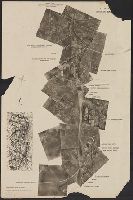
Published / Created:
[1940?]
Call Number:
38gmp B833 1940
Container / Volume:
BRBL_00171
Image Count:
1
Resource Type:
Maps, Atlases & Globes
Description:
Aerial photograph of portion of Bruges railway., Imperfect: Frayed with loss of text., and Title supplied by cataloger.
Publisher:
Advanced Section, Army Printing and Stationery Service,
Subject (Geographic):
Belgium--Maps
Found in:
Beinecke Rare Book and Manuscript Library > [View taken above Bruges].
Published / Created:
1855
Call Number:
811ca 1855
Container / Volume:
BRBL_00554
Image Count:
1
Resource Type:
Maps, Atlases & Globes
Description:
"Entered according to act of Congress by E.J. Hulbert in the year 1855 in the Clerk's Office of the District Court of the United States for the State of Michigan". and Imperfect: Mutilated with some loss of text.
Publisher:
s.n.,]
Subject (Geographic):
Michigan--Maps
Found in:
Beinecke Rare Book and Manuscript Library > [Western part of upper peninsula, Michigan].
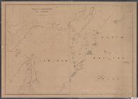
Published / Created:
1845
Call Number:
54635cea 1845
Container / Volume:
BRBL_00290
Image Count:
2
Resource Type:
Maps, Atlases & Globes
Description:
Preliminary record.
Publisher:
W.C. Taber & Son,
Subject (Geographic):
Kamchatskai︠a︡ oblastʹ (Russia)--Maps--Early works to 1800
Found in:
Beinecke Rare Book and Manuscript Library > [Whaling] Chart of Kamscatka, and the Sea of Ochotsk. Copied from the best Russian Authorities. ... respectfully dedicated to the Whaling Fleet of the United States.
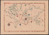
Published / Created:
[1700]
Call Number:
11 1700A
Container / Volume:
BRBL_00004
Image Count:
1
Resource Type:
Maps, Atlases & Globes
Description:
Preliminary record.
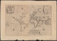
Subject (Geographic):
World--Maps--Early works to 1800
Found in:
Beinecke Rare Book and Manuscript Library > [World Map] Portugal - The Country that has contributed most to geographic knowledge of the Globe in the course of one century she discovered and explored nearly two-thirds of the inhabited Globe.
Published / Created:
March 1880.
Call Number:
11 1584
Container / Volume:
BRBL_00722
Image Count:
2
Resource Type:
Maps, Atlases & Globes
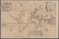
Alternative Title:
The Wright-Molineaux world map.
Description:
"The Typographic Etching Company Photo sc. ... ", Facsimile of original from "The Principal Navigators, Voyages ... " by Richard Hakluyt, London, 1599., and The so-called Wright-Molineaux anonymous world map, London, 1600.
Publisher:
The Hakluyt Society ... ,
Subject (Topic):
Maps--Facsimiles and World maps--Early works to 1800--Facsimiles
Found in:
Beinecke Rare Book and Manuscript Library > [World map].
Published / Created:
March 1880.
Call Number:
11 1600
Container / Volume:
BRBL_00002
Image Count:
1
Resource Type:
Maps, Atlases & Globes
Alternative Title:
The Wright-Molineaux world map.
Description:
"The Typographic Etching Company Photo sc. ... ", Facsimile of original from "The Principal Navigators, Voyages ... " by Richard Hakluyt, London, 1599., and Preliminary record.
Publisher:
The Hakluyt Society ... ,
Subject (Topic):
Maps--Facsimiles and World maps--Early works to 1800--Facsimiles
Found in:
Beinecke Rare Book and Manuscript Library > [World map].
Published / Created:
March 1880.
Call Number:
11 1600
Image Count:
1
Resource Type:
Maps, Atlases & Globes
Alternative Title:
The Wright-Molineaux world map.
Description:
"The Typographic Etching Company Photo sc. ... ", Facsimile of original from "The Principal Navigators, Voyages ... " by Richard Hakluyt, London, 1599., and Preliminary record.
Publisher:
The Hakluyt Society ... ,
Subject (Topic):
Maps--Facsimiles and World maps--Early works to 1800--Facsimiles
Found in:
Beinecke Rare Book and Manuscript Library > [World map].
Call Number:
771 OS9 1836
Container / Volume:
BRBL_00490
Image Count:
1
Resource Type:
Maps, Atlases & Globes
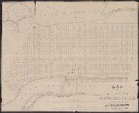
Description:
Inset: The vicinity of Oswego Falls and Preliminary record.
Publisher:
P.A. Messier's, Lith.
Subject (Geographic):
Oswego County (N.Y.)--Maps
Found in:
Beinecke Rare Book and Manuscript Library > map of the Village of Oswego Falls to be Sold on hte Premises by Jas. Bleecker & Sons on the 18th October 1836.
Call Number:
783 1673D
Container / Volume:
BRBL_00507
Image Count:
1
Resource Type:
Maps, Atlases & Globes
Description:
Facsimile.
Subject (Geographic):
Virginia--Maps--Early works to 1800
Found in:
Beinecke Rare Book and Manuscript Library > virginia and Maryland. As it is planted and inhabited this present year 1670. Surveyed and Exactly Drawne by ... Augustin Herrman, 1673.
Branch:v1.61.8 ,Deployed:2024-06-20T11:15:04-04:00