Decorated with sea monsters, mermaids, exotic animals, and cannibals, this wood cut map provides a marked contrast to the simplistic diagrams considered the earliest printed world maps. While the latter presented a world view based in Judeo-Christian theo
Alternative Title:
Typus cosmographicus universalis and Typvs cosmographicvs vniversalis
Description:
Appears in Johann Huttich's Novus orbis regionum. Basel. 1532. and Relief shown pictorially.
Publisher:
[publisher not identified],
Subject (Name):
Holbein, Hans, 1497-1543 and Huttich, Johann, 1480?-1544. Novus orbis regionum.
Janssonius van Waesberge, Johannes, active 1642-1681 Janssonius van Waesberge, Johannes, fl. 1642-1681. English atlas Pitt, Moses, active 1654-1696. English atlas
Published / Created:
[1680]
Call Number:
3531 1680
Container / Volume:
BRBL_00111
Image Count:
1
Resource Type:
Maps, Atlases & Globes
Description:
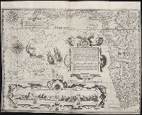
Appears in: The English Atlas, vol. 1 (Koeman 468-9)., Some lettering in gold leaf., Top center: text describing battle between Lithuanian and Ukranian armies., Upper left corner: "XII"., and Verso: stamped "Yale Univ. Lib. Map Coll. Mar 17 1961".
Publisher:
Ex officina Janssonio-Waesbergiana, et Mosis Pitt,
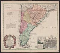
A note on the margin of the map in Latin text gives some historical data and comments upon the climate as being very cold and that the name (Chili) is therefore significan, In Latin and French., Inset: Plan de la ville de Santiago., and Relief shown pictorially.
Publisher:
Editoribus Homannianis Heredibus,
Subject (Geographic):
Santiago (Chile)--Maps--Early works to 1800 and South America--Maps--Early works to 1800
Subject (Name):
Homann Erben (Firm). Atlas geographicus maior and Techo, Nicolás del, 1611-1685
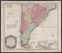
In Latin and French., Includes inset of the Straights of Magellin., Mounted on linen. Sheet measures 53.1 x 62.4 cm., Prime meridian: Ferro., and Relief shown pictorially.
Publisher:
Editoribus Homannianis Heredibus, Norib,
Subject (Geographic):
South America--Maps--Early works to 1800
Subject (Name):
Homann Erben (Firm) and Techo, Nicolás del, 1611-1685
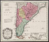
In Latin and French., Includes inset of the Straights of Magellin., Prime meridian: Ferro., Relief shown pictorially., and Sheet measures 50.6 x 58.7 cm. Blue tab pasted on left verso, with stamp "Printed in Germany."
Publisher:
Editoribus Homannianis Heredibus, Norib,
Subject (Geographic):
South America--Maps--Early works to 1800
Subject (Name):
Homann Erben (Firm) and Techo, Nicolás del, 1611-1685
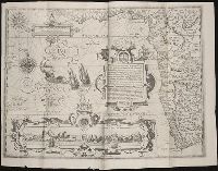
Nauigatio ac itinerarium Iohannis Hugonis Linscotani in Orientalem siue Lusitanorum Indiam
Image Count:
1
Description:
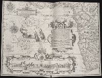
[Scale ca. 1:13,000,000]., Bound in following title page of "Descriptio totius Guineae tractus ...", In ink on top left panel of left verso: 3., and Map has several small tears now repaired on verso.
Subject (Geographic):
Africa, West --Maps --Early works to 1800
Subject (Name):
Claesz, Cornelis, ca. 1546-1609, publisher, Elzevier, Gillis, bookseller, and Hendricksz, Aelbrecht, fl. 1573-1605, printer
Subject (Topic):
Voyages and travels --Early works to 1800
Collection Created:
Hagae-Comitis : Ex officina Alberti Henrici, impensis authoris & Cornelii Nicolai, prostantque apud Aegidium Elseuirum, anno 1599