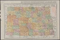
Rand McNally & Co.'s new business atlas map of North Dakota.
Description:
Below scale: Rand McNally & Co.'s new business atlas map of North Dakota. Copyright 1911 ... Copyright 1909 by Rand McNally & Co., Indexed., Relief shown by hachures., and Shows railroads, counties, and drainage.
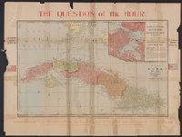
Correct map of the island of Cuba, the city and harbor of Havana, showing location of U.S.S. Maine at the time of her destruction, 9:40 p.m., February 15th 1898 and Question of the hour
Description:
Includes description of "Cuban revolutionary government.", Inset: City of Habana., Relief shown by hachures., and World map, text, and tables included on verso.
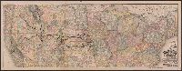
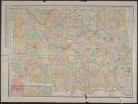
Includes inset map showing congressional districts, rainfall, and soil types., Indexed "Gazetteer of Georgia" on verso., and Shows roads, agricultural schools and experiment stations, counties, and congressional districts.
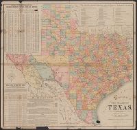
Copyright: Rand, McNally & Co., Includes tables of taxable property and rainfall measures, list of railway lines, and text of state finances., Relief shown by hachures., and Shows counties and railroads.
Publisher:
Rand, McNally & Co.,
Subject (Geographic):
Texas--Administrative and political divisions--Maps and Texas--Maps
Subject (Name):
Spaight, A. W and Texas. Dept. of Agriculture, Insurance, Statistics and History. Resources, soil, and climate of Texas
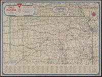
Conoco official road map, Kansas, Kansas, and Travel Kansas with Conoco
Description:
"333-J" and "11-J.", 9 city maps on verso., At head of title: Conoco., Dated from population., Includes index and population statistics., and Relief shown by spot heights.
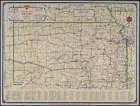
Conoco official road map of Kansas, Kansas, and Travel Kansas with Conoco
Description:
"333-J.C. 10-L" and "1381.", 9 local route maps, text, and ill. on verso., At head of title: Conoco., Includes index and population statistics., and Relief shown by spot heights.
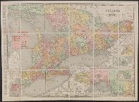
Rand McNally & Co.'s New Business Atlas Map of Ontario
Description:
"Rand McNally & Co.'s New Business Atlas Map of Ontario. Copyright, 1909, by Rand McNally & Co. Copyright, 1892, by Rand McNally & Co.", "The Municpal Counties are shown in tints.", and Includes insets of varying scales: Western Portion of Ontario, River St. Ma