Skip to search
Skip to main content
Skip to first result
Search
You Searched For
Genre
Maps
Genre
Prints (Visual works)
Resource Type
Maps, Atlases & Globes
New Search
Search Results
Published / Created:
1817
Call Number:
Folio Q115 H84 1B
Collection Title:
Atlas geographique et physique des regions equinoxiales du nouveau continent, fonde sur des
Image Count:
1
Resource Type:
Maps, Atlases & Globes
Description:
At foot: Dessine par L. Marchais. / Grave en coloeur par L. Coutant; l'Ecriture par L. Aubert 1817.
Subject (Geographic):
Mexico and South America
Subject (Topic):
Discoveries in geography, Explorers, Plants, Scientific expeditions, and Voyages and travels
Collection Created:
Paris : F. Schoell, 1814
Found in:
Beinecke Rare Book and Manuscript Library > Tableau physique des Ils Canaries. Geographie des plantes du Pic de Teneriffe
Call Number:
1977 +392
Collection Title:
A survey of the cities of London and Westminster : containing the original, antiquity, increase
Image Count:
1
Resource Type:
Maps, Atlases & Globes
Description:
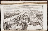
Plate between p. 50-51.
Subject (Geographic):
London (England)--History
Collection Created:
London : Printed for A. Churchill, J. Knapton, R. Knaplock, J. Walthoe [and 6 others], 1720
Found in:
Beinecke Rare Book and Manuscript Library > The Custom House
Call Number:
1977 +392
Collection Title:
A survey of the cities of London and Westminster : containing the original, antiquity, increase
Image Count:
1
Resource Type:
Maps, Atlases & Globes
Description:
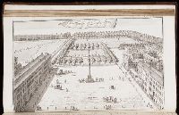
Plate between p. 68-69.
Subject (Geographic):
London (England)--History
Collection Created:
London : Printed for A. Churchill, J. Knapton, R. Knaplock, J. Walthoe [and 6 others], 1720
Found in:
Beinecke Rare Book and Manuscript Library > The Prospect of Grays Inn
Call Number:
1977 +392
Collection Title:
A survey of the cities of London and Westminster : containing the original, antiquity, increase
Image Count:
1
Resource Type:
Maps, Atlases & Globes
Description:
Plate between p. 72-73.
Subject (Geographic):
London (England)--History
Collection Created:
London : Printed for A. Churchill, J. Knapton, R. Knaplock, J. Walthoe [and 6 others], 1720
Found in:
Beinecke Rare Book and Manuscript Library > The Prospect of Lincoln's Inn
Creator:
Call Number:
Ee +633gb
Collection Title:
The voyages and travells of the ambassadors sent by Frederick, duke of Holstein, to the great Duke
Image Count:
1
Resource Type:
Maps, Atlases & Globes
Description:
Between pp. 112-113.
Subject (Geographic):
Asia--Description and travel., East Indies--Description and travel, and Iran--Description and travel.
Subject (Topic):
Voyages and travels
Collection Created:
London : Printed for J. Starkey and T. Basset, 1669
Found in:
Beinecke Rare Book and Manuscript Library > The course of the great River Wolga
Creator:
Call Number:
1977 Folio 96
Collection Title:
The West-India atlas: or, A compendious description of the West-Indies: illustrated with forty
Image Count:
1
Resource Type:
Maps, Atlases & Globes
Alternative Title:
The harbours of Kingston and Port Royal and The windward passage, with the several passages, from the...east end of Cuba, and the north part of St. Domingo.
Description:
With two inset maps.
Subject (Geographic):
Cuba. and Santo Domingo (Dominican Republic)
Subject (Topic):
Nautical charts
Collection Created:
London, Printed for Robert Sayer and John Bennett, Fleet-Street, 1775
Found in:
Beinecke Rare Book and Manuscript Library > The harbour of Bluefields.
Creator:
Call Number:
C6 033c
Collection Title:
The natural and civil history of the French dominions in North and South America : with an
Image Count:
1
Resource Type:
Maps, Atlases & Globes
Description:
Plate between p. 2-3.
Subject (Geographic):
Atlantic Ocean--Charts, maps, etc., Atlantic Ocean--Maps--Early works to 1800, and Santo Domingo (Dominican Republic)
Collection Created:
London, Printed for T. Jeffreys, 1761
Found in:
Beinecke Rare Book and Manuscript Library > The island of Hispaniola called by the French St. Domingo. Subject to France and Spain. from the best authorities by Thomas Jeffreys, geographer to his Royal Highness the Prince of Wales
Branch:v1.61.8 ,Deployed:2024-06-20T11:14:46-04:00