Skip to search
Skip to main content
Skip to first result
Search
You Searched For
Extent of Digitization
Partially digitized
Genre
Hand coloring
Genre
Maps
New Search
Search Results
Published / Created:
1610
Call Number:
Ede +610C
Collection Title:
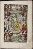
Britain, or, A chronographicall description of the most flourishing kingdomes, England, Scotland
Image Count:
1
Resource Type:
Books, Journals & Pamphlets
Subject (Geographic):
Great Britain
Collection Created:
Londini : impensis G. Bishop & I. Norton, 1610
Found in:
Beinecke Rare Book and Manuscript Library > Britannia
Published / Created:
1756
Call Number:
1973 Folio 119
Collection Title:
Atlas universel, par M. Robert ... et par M. Robert de Vaugondy son fils ...
Image Count:
1
Resource Type:
Maps, Atlases & Globes
Description:
Stamped on verso: "Lorraine" on right and left sides.
Subject (Geographic):
Lorraine (France) --Maps --Early works to 1800
Subject (Name):
Robert de Vaugondy, Didier, 1723-1786
Subject (Topic):
Atlases --Early works to 1800
Collection Created:
Paris, Chez les auteurs, quay de l’Horloge du Palais; Boudet libraire imprimeur du roi, rue St. Jacques, 1757[-58]
Found in:
Beinecke Rare Book and Manuscript Library > Carte de la Lorraine et Du Barrois dans laquelle se trouvent la generalite de metz et autres enclaves; dresseepour la lecture du memoire de M. Durival l'aine, et dediee au Roy de Pologne Duc de Lorraine et de bar par le Sr. Robert de Vaugondy ...
Published / Created:
1753
Call Number:
1973 Folio 119
Collection Title:
Atlas universel, par M. Robert ... et par M. Robert de Vaugondy son fils ...
Image Count:
1
Resource Type:
Maps, Atlases & Globes
Description:
Stamped on verso: "Egypte" on right and left sides.
Subject (Geographic):
Egypt --Maps --Early works to 1800
Subject (Name):
Robert de Vaugondy, Didier, 1723-1786
Subject (Topic):
Atlases --Early works to 1800
Collection Created:
Paris, Chez les auteurs, quay de l’Horloge du Palais; Boudet libraire imprimeur du roi, rue St. Jacques, 1757[-58]
Found in:
Beinecke Rare Book and Manuscript Library > Carte de la l'Egypte ancienne et moderne, dressee sur celle du R.P. Sicard et autres, assujielles aux observations astronomiques par le Sr. Robert de Vaugondy ...
Creator:
Published / Created:
1572]-1618
Call Number:
1975 Folio 41
Image Count:
1
Resource Type:
Maps, Atlases & Globes
Alternative Title:
Civitates orbis terrarum ...
Publisher:
[Coloniae Agrippinae,
Subject (Geographic):
Rome--Antiquities--Early works to 1800 and Rome--Antiquities--Maps
Subject (Topic):
Cities and towns, Medieval and Maps, Pictorial -- (LC)
Found in:
Beinecke Rare Book and Manuscript Library > Civitates orbis terrarvm ...
Published / Created:
[ca. 1675]
Call Number:
GEN MSS VOL 4
Collection Title:
Atlas of the world
Image Count:
1
Resource Type:
Maps, Atlases & Globes
Collection Created:
[Germany?, ca. 1675]
Found in:
Beinecke Rare Book and Manuscript Library > Die gantse welt
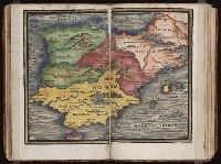
Published / Created:
[1542]
Call Number:
Taylor 86
Collection Title:
Rvdimenta cosmographica
Image Count:
1
Subject (Geographic):
Europe and France
Subject (Topic):
Cosmography, Early maps, and Geography, Medieval
Collection Created:
Impressvm in inclyta Transylvaniae Corona 1542
Found in:
Beinecke Rare Book and Manuscript Library > Gallia
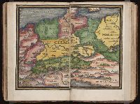
Published / Created:
[1542]
Call Number:
Taylor 86
Collection Title:
Rvdimenta cosmographica
Image Count:
1
Subject (Geographic):
Europe and Germany
Subject (Topic):
Cosmography, Early maps, and Geography, Medieval
Collection Created:
Impressvm in inclyta Transylvaniae Corona 1542
Found in:
Beinecke Rare Book and Manuscript Library > Germania
Published / Created:
[1542]
Call Number:
Taylor 86
Collection Title:
Rvdimenta cosmographica
Image Count:
1
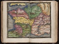
Subject (Geographic):
Spain
Subject (Topic):
Cosmography, Early maps, and Geography, Medieval
Collection Created:
Impressvm in inclyta Transylvaniae Corona 1542
Found in:
Beinecke Rare Book and Manuscript Library > Hispania
Call Number:
1983 Folio 50
Collection Title:
Atlas novus sive Tabulae geographicae totius orbis faciem : partes, imperia, regna et provincias
Image Count:
2
Resource Type:
Maps, Atlases & Globes
Alternative Title:
Erklaerung deren figuren, so sich auf der historischen land-charten von teutschland, und deren angraenzenden laendern befinden
Description:
Both versos blank.
Subject (Topic):
Atlases --Early works to 1800 and Atlases, German
Collection Created:
Augustae Vindelicorum : [M. Seutter, 1757?]
Found in:
Beinecke Rare Book and Manuscript Library > Historia Imperii Romano-Germanici, nec non finitimarum Regionum In Mappa exhibita, ac aeri incisa a Mattheo Seutter ...
Creator:
Published / Created:
[ca. 1556?]
Call Number:
1983 Folio 19
Collection Title:
[Atlas factice of 96 maps by Blaeu, Visscher, Jansson, Hondius and others]
Image Count:
2
Description:
A set of 9 maps (no. IIII-XII) are from the Stumpf-Chronik., Hand col. Sheet measures 38.8 x 50 cm. Ms. notes in 19th century hand at bottom. Reinforced along edges with manuscript waste. No. 45 of 92 maps bound together., and Numbered 49 on verso.
Publisher:
[Christoffel Froschauer]
Subject (Geographic):
Germany, Southern --Maps --Early works to 1800 and Switzerland --Maps --Early works to 1800
Subject (Topic):
Atlases --Early works to 1800
Collection Created:
[1556-1680]
Found in:
Beinecke Rare Book and Manuscript Library > IIII. Die gantz Eydgenoschafft
Branch:v1.61.8 ,Deployed:2024-06-20T11:14:55-04:00