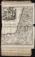
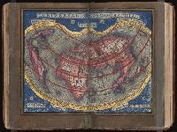
Twenty four new and accurate maps of the several parts of Europe ... : all (except the last) new
Image Count:
1
Alternative Title:
Turkey in Europe
Description:
In pencil on verso: 24. and Table of contents for maps 20-24 misnumbered.
Subject (Geographic):
Turkey --Maps
Subject (Name):
Barker, B. (Benjamin), d. 1764, bookseller, Clements, Henry, d. 1719, bookseller, King, Charles, d. 1735, bookseller, Nicholson, John, d. ca. 1717, bookseller, Parker, Richard, fl. 1692-1725, bookseller, and Tooke, Benjamin, d. 1716, bookseller
Subject (Topic):
Atlases --Early works to 1800
Collection Created:
[London] : Sold by J. Nicholson at the King’s-Arms in Little Britain, Benj. Barker and Charles King ..., Benj. Tooke ..., Hen. Clements ..., R. Parker and Ralph Smith under the Royal-Exchange ..., [1715?]
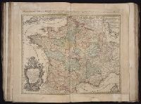
The generall historie of Virginia, New-England, and the Summer Iles : with the names of the
Image Count:
1
Abstract:
Inset depicting Powhatan.
Description:
Between p. 40-41. and Teaching resource: Professor John Mack Faragher, History 141: The American West.
Subject (Geographic):
Virginia --Maps --Early works to 1800
Subject (Topic):
Discoveries in geography, First contact of aboriginal peoples with Westerners, Indians of North America --Virginia --Early works to 1800, and Voyages and travels
Collection Created:
London : Printed by I.[ohn] D.[awson] and I.[ohn] H.[aviland] for Michael Sparkes, 1625
Map of San Francisco imperfect: torn along fold at upper right., Maps linen backed and bound in on tabs., Numerous pagination errors., and Printer’s dummy[?] with printed title page and "avant propos." Text consists of mounted newspaper clippings[?] and original illustrations in pencil and watercolor as well as several prints (from other sources) and two hand drawn and colored maps of San Francisco and Northern California.
Publisher:
Imp. Comm. (Margritat G., Dr)
Subject (Geographic):
California--Maps, Manuscript and San Francisco (Calif.)--Maps, Manuscript
Subject (Topic):
California --Gold discoveries and Voyages to the Pacific coast
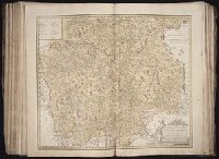
All volumes bound to match 1973 Folio 72. Factitious collection of about 549 maps taken from the atlases of the 17th and the beginning of the 18th cent., put together with the title "Atlas" and bound in 6 volumes. These volumes originally bore the imprint: Amstelaedamii apvd Reiniervm & Josvam Ottens. Over these words on the title-pages of v. 1-2, 4-6 is the name of Henrik de Leth who painted them. Volume 3 has only the erased imprint of Ottens., For fuller description see Phillips 3448 and C. Koeman's Atlantes Neerlandici, bibliography of terrestrial, maritime and celestial atlases and pilot books, published in the Netherlands up to 1800, Amsterdam c1967-71, v. 2, p. 63-83., and Maps by P. Schenck and son, G. Valck, F. de Wit, N. Visscher and others.
Publisher:
chez J. Covens & C. Mortier,
Subject (Geographic):
Denmark --Maps --Early works to 1800
Subject (Name):
Reiner et Josua Ottens (Firm), Schenk, Peter, 1660-1718 or 1719., and Valck, G. (Gerard), 1651 or 1652-1726.