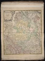
[Atlas factice of 50 maps, primarily by Johann Baptist Homann and/or issued by the Homann Erben
Image Count:
1
Publisher:
Edita sumtibus Homannianorum Heredum
Subject (Geographic):
Bremen (Germany : Duchy) --Maps --Early works to 1800, Hannover (Germany : Province) --Maps --Early works to 1800, Lower Saxony (Germany) --Maps --Early works to 1800, and Westphalia (Germany) --Maps --Early works to 1800
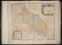
[Atlas factice of 50 maps, primarily by Johann Baptist Homann and/or issued by the Homann Erben
Image Count:
1
Alternative Title:
Ducatus Silesiae tabula geographica generalis, Duche de Silesie suivant l’e´tat present drese par Tobie Maier, et publie par les Heritiers de Homann a Nuremberg, and Dvche de Silesie suivant l’etat present drese par Tobie Maier, et publie par les Heritiers de Homann a Nuremberg
Publisher:
Impensis Homannianorum Heredum
Subject (Geographic):
Silesia (Czech Republic) --Maps --Early works to 1800
Homann Erben (Firm) Homann, Johann Baptist, 1663-1724
Published / Created:
[1741?]
Call Number:
1983 Folio 23
Collection Title:
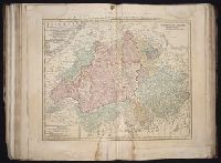
[Atlas factice of 50 maps, primarily by Johann Baptist Homann and/or issued by the Homann Erben
Image Count:
1
Alternative Title:
Allemagne distingue?e en ses cercles & subdivise?e en ses e?tats, contenant son e?tendue pre?sente rectifie?e & me?thodiquement enlumine?e suivant les e?le?ments de ge?ographie de Mr. Schatz a 1741 avec privilege imperial and Imperii Romano Germanici in suos status et circulos divisi tabula generalis
Publisher:
[Homann Erben?]
Subject (Geographic):
Austria --Maps --Early works to 1800, Czechoslovakia --Maps --Early works to 1800, Germany --Maps --Early works to 1800, Hungary --Maps --Early works to 1800, and Poland --Maps --Early works to 1800
Homann Erben (Firm) Homann, Johann Baptist, 1663-1724
Published / Created:
[1746?]
Call Number:
1973 Folio 30
Collection Title:
[Atlas factice of 32 maps and 1 distance table, produced by the Homann Erben firm]
Image Count:
2
Alternative Title:
Allemagne distinguee en ses cercles & subdivisee en ses etats, contenant son etendue presente rectifiee & methodiquement enluminee suivant les elements de geographie de Mr. Schatz and Imperii Romano Germanici in suos status et circulos divisi tabula generalis
Publisher:
[Homann Erben?]
Subject (Geographic):
Austria --Maps --Early works to 1800, Czechoslovakia --Maps --Early works to 1800, Germany --Maps --Early works to 1800, Hungary --Maps --Early works to 1800, and Poland --Maps --Early works to 1800
Homann Erben (Firm) Homann, Johann Baptist, 1663-1724
Published / Created:
ca. 1741
Call Number:
1975 Folio 31
Collection Title:
[Atlas factice of 42 maps, produced by the Homann Erben firm]
Image Count:
2
Alternative Title:
Allemagne distinguee en ses cercles & subdivisee en ses etats, contenant son etendue presente rectifiee & methodiquement enluminee suivant les elements de geographie de Mr. Schatz a 1741 avec privilege imperial and Imperii Romano Germanici in suos status et circulos divisi tabula generalis
Publisher:
Homann Erben?
Subject (Geographic):
Austria --Maps --Early works to 1800, Czechoslovakia --Maps --Early works to 1800, Germany --Maps --Early works to 1800, Hungary --Maps --Early works to 1800, and Poland --Maps --Early works to 1800
Iimage of the Saints Maurus and Placid surrounded by angels in lower left corner., Publisher statement precedes place of publication in imprint., Relief shown pictorially., and Watermark. Manuscript number in right corner: 42. From the Karpinski-von Wieser Map Collection.
Publisher:
Excusa per Haeredes Homan[n]ianos
Subject (Geographic):
Italy--Maps--Early works to 1800.
Subject (Name):
Benedictines and Benedictines--Italy--Maps--Early works to 1800
Subject (Topic):
Ecclesiastical geography and Ecclesiastical geography--Italy--Maps--Early works to 1800.