Skip to search
Skip to main content
Skip to first result
Search
You Searched For
Genre
Engravings
Genre
Maps in books
New Search
Search Results
Call Number:
1973 Folio 116
Collection Title:
The English pilot: describing the West-India navigation, from Hudson's-Bay to the river Amazones
Image Count:
1
Description:
Imperfect: fibrous remnants obscure a slight amount of text.
Subject (Geographic):
Atlantic Ocean --Maps --Early works to 1800 and Newfoundland and Labrador --Maps --Early works to 1800
Subject (Topic):
Navigation --Early works to 1800, Pilot guides --Atlantic Coast (U.S.) --Early works to 1800, and Pilot guides --Caribbean Area --Early works to 1800
Collection Created:
London :
Found in:
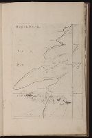
Beinecke Rare Book and Manuscript Library > Harbor Grace
Call Number:
1973 Folio 114
Collection Title:
The English pilot: describing the West-India navigation, from Hudson's-Bay to the river Amazones
Image Count:
1
Resource Type:
Maps, Atlases & Globes
Subject (Geographic):
Atlantic Ocean --Maps --Early works to 1800 and Newfoundland and Labrador --Maps --Early works to 1800
Subject (Topic):
Navigation --Early works to 1800, Pilot guides --Atlantic Coast (U.S.) --Early works to 1800, and Pilot guides --Caribbean Area --Early works to 1800
Collection Created:
London : Printed for W. and J. Mount, T. Page and son, on Tower-Hill, MDCCLIX [1759]
Found in:
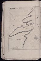
Beinecke Rare Book and Manuscript Library > Harbor Grace
Call Number:
1973 Folio 76
Collection Title:
The English pilot: describing the sea-coasts, capes, head-lands, rivers, bays, roads, havens
Image Count:
2
Description:
Most maps numbered in pencil on verso, some on recto.
Subject (Geographic):
Atlantic Ocean --Maps --Early works to 1800 and Newfoundland and Labrador --Maps --Early works to 1800
Subject (Topic):
Navigation --Early works to 1800, Pilot guides --Atlantic Coast (U.S.) --Early works to 1800, and Pilot guides --Caribbean Area --Early works to 1800
Collection Created:
London : Printed for John Thornton, at the sign of the England, Scotland, and Ireland, in the Minories, and Richard Mount, at the Postern on Tower-Hill, 1698London : Printed for John Thornton, at the sign of the England, Scotland, and Ireland, in the Minories, and Richard Mount, at the Postern on Tower-Hill, 1698
Found in:
Beinecke Rare Book and Manuscript Library > Harbor Grace
Creator:
Published / Created:
ca. 1751
Call Number:
1983 Folio 23
Collection Title:
[Atlas factice of 50 maps, primarily by Johann Baptist Homann and/or issued by the Homann Erben
Image Count:
1
Alternative Title:
Helvetia tredecim statibus liberis, quos cantones vocant composita and Suisse, divisee en ses treze cantons, ses alliez et ses sujets
Publisher:
Luci publicae tradita ab Homannianis Heredibus
Subject (Geographic):
Switzerland --Maps --Early works to 1800
Collection Created:
[Nuremberg : Homann Erben, 1710-1786]
Found in:
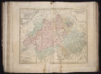
Beinecke Rare Book and Manuscript Library > Helvetia tredecim statibvs liberis, quos cantones vocant composita: una cum foederatis & subjectis provinciis, ex probatissimis subsidiis
Creator:
Published / Created:
a. 1751
Call Number:
1973 Folio 30
Collection Title:
[Atlas factice of 32 maps and 1 distance table, produced by the Homann Erben firm]
Image Count:
2
Alternative Title:
Helvetia tredecim statibus liberis, quos cantones vocant composita and Suisse, divisee en ses treze cantons, ses alliez et ses sujets
Publisher:
Luci publicae tradita ab Homannianis Heredibus
Subject (Geographic):
Switzerland --Maps --Early works to 1800
Subject (Topic):
Atlases, German --Early works to 1800
Collection Created:
[Nuremberg : s.n., 1701-1760]
Found in:
Beinecke Rare Book and Manuscript Library > Helvetia tredecim statibvs liberis, qvos cantones vocant composita [cartographic material] : una cum foederatis & subjectis provinciis, ex probatissimis subsidiis / geographice delineata per Dm. Tobiam Mayerum, Professorem Matth., Goettingensem
Creator:
Published / Created:
1715?
Call Number:
1975 Folio 31
Collection Title:
[Atlas factice of 42 maps, produced by the Homann Erben firm]
Image Count:
1
Publisher:
Johann Baptist Homann
Subject (Geographic):
Ireland --Maps --Early works to 1800
Subject (Topic):
Atlases, German --Early works to 1800
Collection Created:
[Nuremberg,
Found in:
Beinecke Rare Book and Manuscript Library > Hiberniae regnum tam in praecipuas Ultoniae, Connaciae, Laceniae et Momoniae [cartographic material] : quam in minores earundem provincias et ditiones divisum ex prototype Guil. Petty-Vischeriano deductu et exhibitum / a Joh. Bapt. Homanno
Creator:
Published / Created:
1788 January 1
Call Number:
1982 Folio 10
Image Count:
1
Description:
No. 30 of 43 maps bound together in composite atlas., Relief shown pictorially., and Scale [ca. 1:5,650,000].
Publisher:
William Faden
Subject (Geographic):
India --Maps --Early works to 1800
Found in:
Beinecke Rare Book and Manuscript Library > Hind, Hindoostan, or India
Call Number:
Taylor 192 4-6
Collection Title:
Americae pars quinta nobilis & admiratione plena Hieronymi Bezoni Mediolanensis secundae sectionis
Image Count:
1
Subject (Geographic):
America --Discovery and exploration --Spanish --Early works to 1800, America --Early accounts to 1600, Latin America --Description and travel --Early works to 1800, Latin America --History --To 1600, and Mexico --Ma
Subject (Name):
Benzoni, Girolamo, b. 1519. Historia del Mondo Nuovo. Book 2. Latin, Bry, Theodor de, 1528-1598, and Chauveton, Urbain, d. ca. 1616
Collection Created:
[Frankfurt am Main : Theodore de Bry, 1595]
Found in:
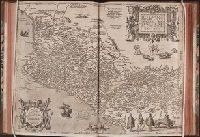
Beinecke Rare Book and Manuscript Library > Hispaniae Novae Sive Magnae, Recens et Vera Descriptio 1595
Call Number:
1983 Folio 50
Collection Title:
Atlas novus sive Tabulae geographicae totius orbis faciem : partes, imperia, regna et provincias
Image Count:
2
Resource Type:
Maps, Atlases & Globes
Alternative Title:
Erklaerung deren figuren, so sich auf der historischen land-charten von teutschland, und deren angraenzenden laendern befinden
Description:
Both versos blank.
Subject (Topic):
Atlases --Early works to 1800 and Atlases, German
Collection Created:
Augustae Vindelicorum : [M. Seutter, 1757?]
Found in:
Beinecke Rare Book and Manuscript Library > Historia Imperii Romano-Germanici, nec non finitimarum Regionum In Mappa exhibita, ac aeri incisa a Mattheo Seutter ...
Creator:
Published / Created:
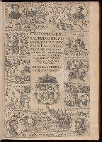
1601-15.
Call Number:
Zc50 601he
Image Count:
15
Resource Type:
Books, Journals & Pamphlets
Description:
Fully described in H.R. Wagner, The Spanish Southwest, no. 12. and Includes "Descripcion de las Indias Ocidentales": [v. 2].
Publisher:
en la Emplenta real,
Subject (Geographic):
America--Discovery and exploration, America--Early accounts to 1600, and Latin America--History--To 1600
Subject (Topic):
Discoveries in geography
Found in:
Beinecke Rare Book and Manuscript Library > Historia general de los hechos de los castellanos en las Islas i Tierra Firme del Mar Oceano, escrita por Antonio de Herrera.
Branch:v1.61.8 ,Deployed:2024-06-20T11:14:46-04:00