Skip to search
Skip to main content
Skip to first result
Search
You Searched For
Genre
Maps
New Search
Search Results
Call Number:
402 M763 1840
Container / Volume:
BRBL_00233A
Image Count:
3
Resource Type:
Maps, Atlases & Globes
Subject (Geographic):
Brescia (Italy)--Maps
Subject (Name):
Antonini, L and Caniani, J
Found in:
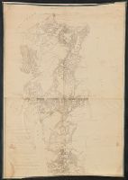
Beinecke Rare Book and Manuscript Library > Camp de Montechiaro et ses environs / gravé à Milan par L. Antonini, et J. Caniani.
Published / Created:
[between 1640 and 1643]
Call Number:
406 1640
Container / Volume:
BRBL_00236
Image Count:
2
Resource Type:
Maps, Atlases & Globes
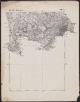
Description:
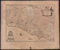
Relief shown pictorially., Signature 3M, page number 64 on verso., Stamp: Karpinski-von Wieser Map Collection., and Text on verso in Latin.
Publisher:
[Blaeu],
Subject (Geographic):
Campagna di Roma (Italy)--Maps--Early works to 1800 and Lazio (Italy)--Maps--Early works to 1800
Found in:
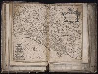
Beinecke Rare Book and Manuscript Library > Campagna di Roma, olim Latium : Patrimonio di S. Pietro et Sabina.
Creator:
Published / Created:
[164-?]
Call Number:
1983 Folio 19
Collection Title:
[Atlas factice of 96 maps by Blaeu, Visscher, Jansson, Hondius and others]
Image Count:
1
Description:
Imperfect: torn along fold, with some loss of text.. Sheet measures 38.9 x 49.2 cm. No. 15 of 92 maps bound together.
Publisher:
Willem Janszoon Blaeu
Subject (Geographic):
Lazio (Italy) --Maps --Early works to 1800
Subject (Name):
Blaeu, Cornelis, dedicator and Dal Pozzo, Cassiano, 1588-1657, dedicatee
Collection Created:
[1556-1680]
Found in:
Beinecke Rare Book and Manuscript Library > Campagna di Roma, olim Latium : patrimonio di S. Pietro
Call Number:
783hc 1781
Container / Volume:
BRBL_00511
Image Count:
4
Resource Type:
Maps, Atlases & Globes
Description:
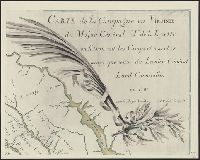
Photograph of manuscript. Original at Raleigh Tavrn, Williamsburg, Va.
Subject (Geographic):
Virginia--Maps--Early works to 1800
Found in:
Beinecke Rare Book and Manuscript Library > Campagne en Virginie du Major Général M. de La Fayette, ou se trouvent les Camps et Marches ainsy que ceux du Lieutenant Général Ld. Cornwallis, par le Major Capitaine, Aide de Camp de Gl. La Fayette en 1781.
Call Number:
783hc 1781
Container / Volume:
BRBL_00511
Image Count:
4
Resource Type:
Maps, Atlases & Globes
Description:
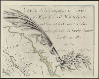
Photograph of manuscript. Original at Raleigh Tavrn, Williamsburg, Va.
Subject (Geographic):
Virginia--Maps--Early works to 1800
Found in:
Beinecke Rare Book and Manuscript Library > Campagne en Virginie du Major Général M. de La Fayette, ou se trouvent les Camps et Marches ainsy que ceux du Lieutenant Général Ld. Cornwallis, par le Major Capitaine, Aide de Camp de Gl. La Fayette en 1781.
Call Number:
783hc 1781
Container / Volume:
BRBL_00511
Image Count:
4
Resource Type:
Maps, Atlases & Globes
Description:
Photograph of manuscript. Original at Raleigh Tavrn, Williamsburg, Va.
Subject (Geographic):
Virginia--Maps--Early works to 1800
Found in:
Beinecke Rare Book and Manuscript Library > Campagne en Virginie du Major Général M. de La Fayette, ou se trouvent les Camps et Marches ainsy que ceux du Lieutenant Général Ld. Cornwallis, par le Major Capitaine, Aide de Camp de Gl. La Fayette en 1781.
Creator:
Published / Created:
1862
Call Number:
783hc 1862E
Container / Volume:
BRBL_00511
Image Count:
3
Resource Type:
Maps, Atlases & Globes
Description:
no. 1. Yorktown to Williamsburg -- no. 2. Williamsburg to White House -- no. 3. White House to Harrison's Landing., Relief shown by hachures., and Yale copy: each sheet comprises 4 sections, mounted on linen. "Photographed at the Coast Survey office." Shows no
Publisher:
Corps of Engineers?]
Subject (Geographic):
Virginia Peninsula (Va.)--Maps
Subject (Name):
Dougal, William H., 1822-1895, Humphreys, A. A. (Andrew Atkinson), 1810-1883, Julius Bien & Co, United States Coast Survey., and United States. Army of the Potomac
Subject (Topic):
Peninsular Campaign, 1862--Maps and Williamsburg, Battle of, Williamsburg, Va., 1862--Maps
Found in:
Beinecke Rare Book and Manuscript Library > Campaign maps, Army of the Potomac / prepared by command of Maj. Gen. George B. McClellan ; compilation under the direction of Brig. Gen. A.A. Humphreys, by Capt. H.L. Abbot ; engraved by W.H. Dougal ; Julius Bien & Co., photo lith.
Creator:
Published / Created:
1862]
Call Number:
783hc 1862F
Container / Volume:
BRBL_00511
Image Count:
3
Resource Type:
Maps, Atlases & Globes
Description:
no. 1. Yorktown to Williamsburg -- no. 2. Williamsburg to White House -- no. 3. White House to Harrison's Landing. and Relief shown by hachures.
Publisher:
Corps of Topographical Engineers?
Subject (Geographic):
Virginia Peninsula (Va.)--Maps
Subject (Name):
Humphreys, A. A. (Andrew Atkinson), 1810-1883, United States. Army of the Potomac, United States. Army. Corps of Topographical Engineers, and Walker, L. E
Subject (Topic):
Peninsular Campaign, 1862--Maps
Found in:
Beinecke Rare Book and Manuscript Library > Campaign maps, Army of the Potomac / prepared by command of Maj. Gen. George B. McClellan [under direction of] A.A. Humphreys, Brig. Gen. and chief of Top. Engrs. ; compiled by Capt. H.L. Abbot, Top. Engrs., September 1862 ; photographic reduction by L.E.
Published / Created:
1863
Call Number:
783hc 1863W
Container / Volume:
BRBL_00512
Image Count:
1
Resource Type:
Maps, Atlases & Globes
Description:
no. 3. White House to Harrison's Landing.
Publisher:
War Dept.
Subject (Geographic):
Virginia--Maps
Found in:
Beinecke Rare Book and Manuscript Library > Campaign maps, Army of the Potomac : Map no. 3. White House to Harrison's Landing / prepared by command of Maj. Gen. George B. McClellan [under direction of] A.A. Humphreys, Brig. Gen. and chief of Top. Engrs. ; compiled by Capt. H.L. Abbot, Top. Engrs.
Published / Created:
1870?]
Call Number:
4073cbf 1870
Container / Volume:
BRBL_00237
Image Count:
3
Resource Type:
Maps, Atlases & Globes
Description:
Foglio 61 (Parte Orientale). Napoli -- Folgio 62 (Parte Occidentale). Castellammare -- Folgio 62 (Parte Orientale). Castellammare.
Publisher:
s.n.,
Subject (Geographic):
Campania (Italy)--Maps
Found in:
Beinecke Rare Book and Manuscript Library > Campania, section of Pozzuoli, Napoli, to Castellammare.
Branch:v1.61.6 ,Deployed:2024-06-12T09:55:19-04:00