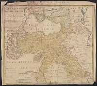
Appears in: Theatrum Terrae Sanctae et biblicarum historiarum / Christiaan van Adrichem. Colonia Agrippina : Birckmannica, 1590., Cartographer from dealer's notes., Has watermark., Oriented with north toward the left., Relief shown pictorially., and Shows portion
Publisher:
Birckmannica,
Subject (Geographic):
Palestine--History--To 70 A.D.--Maps and Palestine--Maps--Early works to 1800
Appears in 1590 and 1682 eds. of Theatrum terrae., Laor contributes this map to Christian van Adrichom in Cologne, ca. 1590., Oriented to the east., Relief shown pictorially., and Shows portion of the Holy Land given to the Tribe of Reuben at the time of the divi
Publisher:
Birckmannica,
Subject (Geographic):
Palestine--History--To 70 A.D.--Maps and Palestine--Maps--Early works to 1800
Subject (Name):
Adrichem, Chirstiaan van, 1533-1585. Theatrum Terrae Sanctae and Birckmann, Johann, 1527-1572
Carte de la Turquie Asiatique contenant la Natolie Moderne divisée en fes Beglerbeys &.
Description:
"C.P.S.C.M.", Bar scales given in "milliaria Germanica," "milliaria Turcica terrestria," and "milliaria Turcica marina"., Imperfect: chewed at edges, witn some loss of text. Sheet measures 48.6 x 54.7 cm., Prime meridian: Ferro., Relief shown pictorially., and Wat
Publisher:
Impensis Homannianorum Heredum,
Subject (Geographic):
Middle East--Maps--Early works to 1800 and Turkey--Maps--Early works to 1800
Mellinger, Johannes, approximately 1538-1603, cartographer
Call Number:
369 1650
Container / Volume:
BRBL_00146
Image Count:
2
Resource Type:
Maps, Atlases & Globes
Alternative Title:
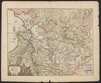
Misniae et Lusatiae tabula, Misniae et Lvsatiae tabvla, and Tvringiae noviss. descript.
Description:
Bar scales given in "Scala miliarium Germanicorum.", Erroneous longitude numerals 20-30-31 in the right hand border of "Misniae et Lusatiae tabula.", From Abraham Ortelius' Theatr, In Latin on verso, with caption title "Turingia" and paginated 29., and Watermark.
Subject (Geographic):
Brandenburg (Germany)--Maps--Early works to 1800, Saxony (Germany)--Maps--Early works to 1800, Saxony-Anhalt (Germany)--Maps--Early works to 1800, and Thuringia (Germany)--Maps--Early works to 1800
Subject (Name):
Ortelius, Abraham, 1527-1598. Theatrum orbis terrarum. 1575 and Scultetus, Bartholomäus, 1540-1614
Blaeu, Joan, 1596-1673. Theatrum orbis terrarum Blaeu, Willem Janszoon, 1571-1638 Blaeu, Willem Janszoon, 1571-1638. Theatrum orbis terrarum
Published / Created:
[ca. 163-?]
Call Number:
1983 Folio 19
Collection Title:
[Atlas factice of 96 maps by Blaeu, Visscher, Jansson, Hondius and others]
Image Count:
2
Resource Type:
Maps, Atlases & Globes
Alternative Title:
Imperium Turcicum in Europa, Asia et Africa regiones proprias, tributar, et clientelares exhibens and Turcicum imperium
Description:
Imperfect: torn and mutilated along fold and edges, partially repaired, with some loss of text; cartouche cut-out and replicated in ms. with new title.