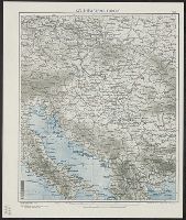
United States. Office of Strategic Services. Research and Analysis Branch
Published / Created:
[1944]
Call Number:
53cbf 1944A
Container / Volume:
BRBL_00286
Image Count:
1
Resource Type:
Maps, Atlases & Globes
Alternative Title:
Geographical Section, General Staff ; no. 4464 and GSGS (Series) ; 4464.
Description:
"14 October 1944.", "From: Geographical Section, General Staff, No. 4464. Published by War Office, 1944.", "No. A-5484-R & A, OSS.", and Relief shown by contours, hypsometric tints, and spot heights.
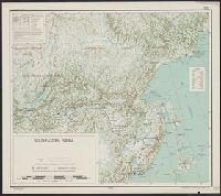
United States. Office of Strategic Services. Research and Analysis Branch
Published / Created:
1944
Call Number:
30gf 1944
Container / Volume:
BRBL_00037B
Image Count:
1
Resource Type:
Maps, Atlases & Globes
Description:
"Map no. 5531, 14 November, 1944.", Includes index of major coal fields and reliability diagram., and Shows iron mining districts, steel centers and coal fields.
Publisher:
R & A, OSS,
Subject (Geographic):
Europe--Maps
Subject (Topic):
Coal--Europe--Maps, Iron mines and mining--Europe--Maps, and Steel--Europe--Maps