Search
You Searched For
Search Results
- Creator:
- Jefferys, Thomas, d. 1771
- Published / Created:
- 1794
- Call Number:
- 795cea 1794
- Container / Volume:
- BRBL_00523
- Image Count:
- 1
- Resource Type:
- Maps, Atlases & Globes
- Found in:
- Beinecke Rare Book and Manuscript Library > The western coast of Louisiana and the coast of New Leon / by Thos. Jefferys, geographer to His Majesty.
- Published / Created:
- 1794 May 12
- Call Number:
- 755 1794G
- Container / Volume:
- BRBL_00436
- Image Count:
- 1
- Resource Type:
- Maps, Atlases & Globes
- Found in:
- Beinecke Rare Book and Manuscript Library > A new and correct map of the British colonies in North America comprehending eastern Canada with the province of Quebec, New Brunswick, Nova Scotia, and the Government of Newfoundland [cartographic material] : with the adjacent states of New England, Verm
- Published / Created:
- 1794 May 12
- Call Number:
- 755 1794E
- Container / Volume:
- BRBL_00436
- Image Count:
- 1
- Resource Type:
- Maps, Atlases & Globes
- Found in:
- Beinecke Rare Book and Manuscript Library > A new and correct map of the British colonies in North America comprehending eastern Canada with the province of Quebec, New Brunswick, Nova Scotia, and the Government of Newfoundland [cartographic material] : with the adjacent states of New England, Verm
- Creator:
- Fry, Joshua, approximately 1700-1754
- Published / Created:
- 1794
- Call Number:
- 783 1794
- Container / Volume:
- BRBL_00507
- Image Count:
- 1
- Resource Type:
- Maps, Atlases & Globes
- Found in:
- Beinecke Rare Book and Manuscript Library > A map of the most inhabited part of Virginia containing the whole province of Maryland with part of Pensilvania, New Jersey and North Carolina / drawn by Joshua Fry & Peter Jefferson in 1775.
- Published / Created:
- 1794 May 12
- Call Number:
- 71 1794A
- Container / Volume:
- BRBL_00687
- Image Count:
- 1
- Resource Type:
- Maps, Atlases & Globes
- Found in:
- Beinecke Rare Book and Manuscript Library > A new and correct map of the British colonies in North America comprehending eastern Canada with the province of Quebec, New Brunswick, Nova Scotia, and the Government of Newfoundland [cartographic material] : with the adjacent states of New England, Verm
- Published / Created:
- 12th May, 1794.
- Call Number:
- 71 1794L
- Container / Volume:
- BRBL_00726
- Image Count:
- 1
- Resource Type:
- Maps, Atlases & Globes
- Found in:
- Beinecke Rare Book and Manuscript Library > A new and correct map of the British colonies in North America comprehending eastern Canada with the province of Quebec, New Brunswick, Nova Scotia, and the Government of Newfoundland [cartographic material] : with the adjacent states of New England, Verm
- Creator:
- Pownall, Thomas, 1722-1805
- Published / Created:
- 1794 May 12
- Call Number:
- 71 1794
- Container / Volume:
- BRBL_00367
- Image Count:
- 2
- Resource Type:
- Maps, Atlases & Globes
- Found in:
- Beinecke Rare Book and Manuscript Library > A new map of North America with the West India Islands : divided according to the preliminary articles of peace, signed at Versailles, 20 Jan. 1783, wherein are particularly distinguished the United States, and the several provinces, governments &ca which
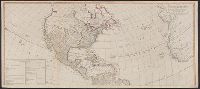
- Creator:
- Anville, Jean Baptiste Bourguignon d', 1697-1782
- Published / Created:
- 1794
- Call Number:
- 70 1794
- Container / Volume:
- BRBL_00686
- Image Count:
- 2
- Resource Type:
- Maps, Atlases & Globes
- Found in:
- Beinecke Rare Book and Manuscript Library > A new map of the whole continent of America : divided into North and South and West Indies wherein are exactly described the United States of North America as well as the several European possessions according to the preliminaries of peace signed at Versa
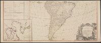
- Creator:
- Anville, Jean Baptiste Bourguignon d', 1697-1782
- Published / Created:
- 1794
- Call Number:
- 70 1794
- Container / Volume:
- BRBL_00725
- Image Count:
- 2
- Resource Type:
- Maps, Atlases & Globes
- Found in:
- Beinecke Rare Book and Manuscript Library > A new map of the whole continent of America : divided into North and South and West Indies wherein are exactly described the United States of North America as well as the several European possessions according to the preliminaries of peace signed at Versa