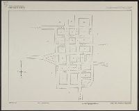
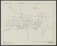
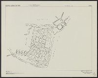
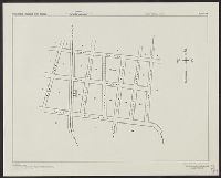
Search
You Searched For
Search Results
- Creator:
- Manila Fire Insurance Association
United States. Army Map Service
- Published / Created:
- 1944
- Call Number:
- 28 L116 1944
- Container / Volume:
- BRBL_00023F
- Image Count:
- 1
- Resource Type:
- Maps, Atlases & Globes
- Alternative Title:
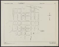
- A.M.S. ; S901, La Carlota, Philippine Islands, Negros Occidental Province, and Series (Standard map series designation system) ; S901.
- Description:
- "Copied from a map prepared by Manila Fire Insurance Association, 1939." and Most streets are named.
- Publisher:
- The Service,
- Subject (Geographic):
- La Carlota (Negros Occidental, Philippines)--Maps
- Found in:
- Beinecke Rare Book and Manuscript Library > Philippine Islands city plans. La Carlota.
- Creator:
- Manila Fire Insurance Association
United States. Army Map Service
- Published / Created:
- 1944
- Call Number:
- 28 L298 1944
- Container / Volume:
- BRBL_00023F
- Image Count:
- 1
- Resource Type:
- Maps, Atlases & Globes
- Alternative Title:
- A.M.S. S901, Laoag, Philippine Islands, Ilocos Norte Province, and Series (Standard map series designation system) ; S901.
- Description:
- "Copied from a map prepared by Manila Fire Insurance Association, 1937." and Streets are named.
- Publisher:
- The Service,
- Subject (Geographic):
- Laoag (Philippines)--Maps
- Found in:
- Beinecke Rare Book and Manuscript Library > Philippine Islands city plans. Laoag.
- Creator:
- Manila Fire Insurance Association
United States. Army Map Service
- Published / Created:
- 1944
- Call Number:
- 28 N13 1944
- Container / Volume:
- BRBL_00024
- Image Count:
- 1
- Resource Type:
- Maps, Atlases & Globes
- Alternative Title:
- A.M.S. ; S901, Naga, Philippine Islands, Camarines Sur Province, and Series (Standard map series designation system) ; S901.
- Description:
- "Copied from a map prepared by Manila Fire Insurance Association, 1939.", Most streets are named., and Oriented with east toward the top.
- Publisher:
- The Service,
- Subject (Geographic):
- Naga (Camarines Sur, Philippines)--Maps
- Found in:
- Beinecke Rare Book and Manuscript Library > Philippine Islands city plans. Naga.
- Creator:
- Manila Fire Insurance Association
United States. Army Map Service
- Published / Created:
- 1944
- Call Number:
- 28 OR5 1944
- Container / Volume:
- BRBL_00024
- Image Count:
- 1
- Resource Type:
- Maps, Atlases & Globes
- Alternative Title:
- A.M.S. ; S901, Ormoc, Philippine Islands, Leyte Province, and Series (Standard map series designation system) ; S901.
- Description:
- "Copied from a map prepared by Manila Fire Insurance Association, 1926." and Streets are named.
- Publisher:
- The Service,
- Subject (Geographic):
- Ormoc (Philippines)--Maps
- Found in:
- Beinecke Rare Book and Manuscript Library > Philippine Islands city plans. Ormoc.
- Creator:
- Manila Fire Insurance Association
United States. Army Map Service
- Published / Created:
- 1944
- Call Number:
- 28 P85 1944
- Container / Volume:
- BRBL_00024
- Image Count:
- 1
- Resource Type:
- Maps, Atlases & Globes
- Alternative Title:
- A.M.S. ; S901, Pototan, Philippine Islands, Iloilo Province, and Series (Standard map series designation system) ; S901.
- Description:
- "Copied from a map prepared by Manila Fire Insurance Association, 1925." and Streets are named.
- Publisher:
- The Service,
- Subject (Geographic):
- Pototan (Iloilo, Philippines)--Maps
- Found in:
- Beinecke Rare Book and Manuscript Library > Philippine Islands city plans. Pototan.
- Creator:
- U.S. Coast and Geodetic Survey
United States. Army Map Service
- Published / Created:
- 1944
- Call Number:
- 28 SA522 1944
- Container / Volume:
- BRBL_00024
- Image Count:
- 1
- Resource Type:
- Maps, Atlases & Globes
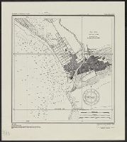
- Alternative Title:
- A.M.S. ; S901, San Fernando, Philippine Islands, La Union Province, and Series (Standard map series designation system) ; S901.
- Description:
- "Copied from U.S.C. & G.S. chart 4246." and Depth given in soundings.
- Publisher:
- The Service,
- Subject (Geographic):
- San Fernando (La Union, Philippines)--Maps
- Found in:
- Beinecke Rare Book and Manuscript Library > Philippine Islands city plans. San Fernando.
- Creator:
- Manila Fire Insurance Association
United States. Army Map Service
- Published / Created:
- 1944
- Call Number:
- 28 SI315 1944
- Container / Volume:
- BRBL_00024
- Image Count:
- 1
- Resource Type:
- Maps, Atlases & Globes
- Alternative Title:
- A.M.S. S901, Series (Standard map series designation system) ; S901., and Silay, Philippine Islands, Negros Occidental Province
- Description:
- "Copied from a map prepared by Manila Fire Insurance Association, 1939." and Most streets are named.
- Publisher:
- The Service,
- Subject (Geographic):
- Silay City (Negros Occidental, Philippines)--Maps
- Found in:
- Beinecke Rare Book and Manuscript Library > Philippine Islands city plans. Silay.
- Creator:
- U.S. Coast and Geodetic Survey
United States. Army Map Service
- Published / Created:
- 1944
- Call Number:
- 28 T11 1944
- Container / Volume:
- BRBL_00024
- Image Count:
- 1
- Resource Type:
- Maps, Atlases & Globes
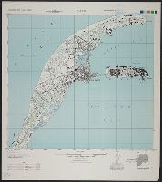
- Alternative Title:
- A.M.S. ; S901, Series (Standard map series designation system) ; S901., and Taal and Lemery, Philippine Islands, Batangas Province
- Description:
- "Copied from U.S.C. & G.S. chart 4257 ... From survey in 1905." and "Soundings in feet at mean lower low water."
- Publisher:
- The Service,
- Subject (Geographic):
- Lemery (Batangas, Philippines)--Maps and Taal (Batangas, Philippines)--Maps
- Found in:
- Beinecke Rare Book and Manuscript Library > Philippine Islands city plans. Taal and Lemery.
- Creator:
- United States. Army Map Service
- Published / Created:
- 1944
- Call Number:
- 28 T175 1944
- Container / Volume:
- BRBL_00024
- Image Count:
- 1
- Resource Type:
- Maps, Atlases & Globes
- Alternative Title:
- A.M.S. ; S901, Series (Standard map series designation system) ; S901., and Tarlac, Philippine Islands, Tarlac Province
- Publisher:
- The Service,
- Subject (Geographic):
- Tarlac (Philippines)--Maps
- Found in:
- Beinecke Rare Book and Manuscript Library > Philippine Islands city plans. Tarlac.
- Creator:
- United States. Army Map Service
- Published / Created:
- 1944
- Call Number:
- 28 C316 1944
- Container / Volume:
- BRBL_00023F
- Image Count:
- 1
- Resource Type:
- Maps, Atlases & Globes
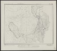
- Alternative Title:
- A.M.S. ; S901, Cavite, Philippine Islands, Cavite Province, Luzon, and Series (Standard map series designation system) ; S901.
- Description:
- Marginal map: Coverage diagram. and Military grid.
- Publisher:
- The Service,
- Subject (Geographic):
- Cavite Province (Philippines)--Maps
- Found in:
- Beinecke Rare Book and Manuscript Library > Philippine city plans, 1:10,000. Cavite.