All volumes bound to match 1973 Folio 72. Factitious collection of about 549 maps taken from the atlases of the 17th and the beginning of the 18th cent., put together with the title "Atlas" and bound in 6 volumes. These volumes originally bore the imprint: Amstelaedamii apvd Reiniervm & Josvam Ottens. Over these words on the title-pages of v. 1-2, 4-6 is the name of Henrik de Leth who painted them. Volume 3 has only the erased imprint of Ottens., For fuller description see Phillips 3448 and C. Koeman's Atlantes Neerlandici, bibliography of terrestrial, maritime and celestial atlases and pilot books, published in the Netherlands up to 1800, Amsterdam c1967-71, v. 2, p. 63-83., and Maps by P. Schenck and son, G. Valck, F. de Wit, N. Visscher and others.
Publisher:
chez J. Covens & C. Mortier,
Subject (Geographic):
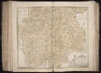
Denmark --Maps --Early works to 1800
Subject (Name):
Reiner et Josua Ottens (Firm), Schenk, Peter, 1660-1718 or 1719., and Valck, G. (Gerard), 1651 or 1652-1726.
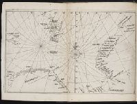
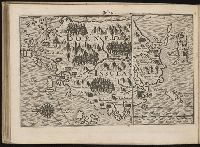
Descriptio ac delineatio geographica detectionis freti, sive, transitus ad occasum supra terras
Image Count:
1
Description:
Bound in after p. [40]., Map has water stain on recto in upper right corner., Printed on recto in lower right corner: F., and Scale [ca. 1:10,000,000].
Subject (Geographic):
Barents Sea --Maps --Early works to 1800. and Norwegian Sea --Maps --Early works to 1800
Collection Created:
Amsterodami Ex officina Hesse lij Gerardi. Anno 1613
Cosmographia Petri Apiani / per Gemmam Frisium apud Louanienses medicum et mathematicum insignem, iam demum ab omnibus vindicata mendis, ac nonnullis quoque locis aucta, & annotationibus marginalibus illustrata. ; Additis eiusdem argumenti
Eigentliche vnd warhafftige Beschreibung / der wunderbaerlichen Schiffarth (der Hollaender
Image Count:
1
Description:
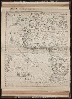
Map has small brown mark on both the recto and verso at the bottom of the map frame below and to the left of the word "Linie"., Map has small water stain on both the recto and verso in the lower right corner of the page that meets with the gutter., Printed above map in center of page: Fol. 73., and Scale [ca. 1:6,500,000].
Subject (Geographic):
Borneo --Maps --Early works to 1800
Collection Created:
Gedruckt zu Amsterdam / Durch Cornelium Nicolaum / Anno 1602