Skip to search
Skip to main content
Skip to first result
Search
You Searched For
Format
cartographic
Language
Italian
New Search
Search Results
Creator:
Call Number:
Art Storage 1980 156
Image Count:
2
Resource Type:
Maps, Atlases & Globes
Description:
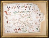
Contains eight compass roses., Decoration: armorial shields, city views with gilded banners, tents, and Madonna with child., In frame 92 x 118 cm., Pen-and-ink in brown, red, blue and green., Portolan chart with seaport names given for all coastlines., and Title devised by cataloger.
Subject (Geographic):
Baltic Sea--Maps--Early works to 1800., Mediterranean Sea--Maps--Early works to 1800., and North Atlantic Ocean--Maps--Early works to 1800.
Subject (Topic):
Manuscript maps --Mediterranean Region, Portolanos --Europe, and Portolanos --Mediterranean Region
Found in:
Beinecke Rare Book and Manuscript Library > [Portolan chart of the Mediterranean Sea, the North Atlantic Ocean, the Baltic Sea, and the West African coast].
Published / Created:
1643
Call Number:
11 1643
Container / Volume:
BRBL_00700
Image Count:
1
Resource Type:
Maps, Atlases & Globes
Description:
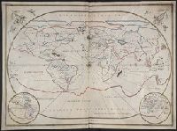
[Joannes Oliva, Leghorn, 1643]., Giovane Oliva de Messina fatta in liorno año 1643., and Manuscript on vellum.
Subject (Geographic):
World--Maps, Manuscript--Early works to 1800
Found in:
Beinecke Rare Book and Manuscript Library > [Portolan chart of the World].
Published / Created:
[1885?].
Call Number:
40 R66 1885A
Container / Volume:
BRBL_00219
Image Count:
1
Resource Type:
Maps, Atlases & Globes
Description:
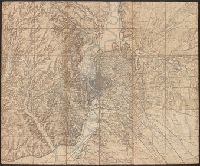
Title supplied by cataloger.
Publisher:
s.n.,
Subject (Geographic):
Rome (Italy : Province)--Maps
Found in:
Beinecke Rare Book and Manuscript Library > [Rome and Environs].
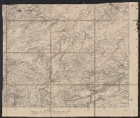
Creator:
Published / Created:
[187-?]
Call Number:
40 R66 1910A
Container / Volume:
BRBL_00219
Image Count:
1
Resource Type:
Maps, Atlases & Globes
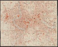
Description:
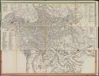
Index in Italian., Indexed., Relief shown by hachures., and Title supplied by cataloger.
Publisher:
Geograph. Anst. v. Wagner & Debes,
Subject (Geographic):
Rome (Italy)--Maps
Subject (Name):
Kiepert, Heinrich, 1818-1899
Found in:
Beinecke Rare Book and Manuscript Library > [Rome] [cartographic material] / H. Kiepert dis.
Published / Created:
1910]
Call Number:
40 R66 1910
Container / Volume:
BRBL_00219
Image Count:
1
Resource Type:
Maps, Atlases & Globes
Description:
"From Hand-book" on catalog card.
Publisher:
s.n.,
Subject (Geographic):
Rome (Italy)--Maps
Found in:
Beinecke Rare Book and Manuscript Library > [Rome].
Published / Created:
1880?]
Call Number:
408 1880
Container / Volume:
BRBL_00238
Image Count:
1
Resource Type:
Maps, Atlases & Globes
Publisher:
s.n.,
Subject (Geographic):
Sicily (Italy)--Maps
Found in:
Beinecke Rare Book and Manuscript Library > [South East section of Sicily].
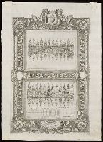
Creator:
Call Number:
Lanman 11 1693
Image Count:
1
Resource Type:
Maps, Atlases & Globes
Description:
From Coronelli's Corso geografico universale., Globe gores for small celestial and terrestrial globes by Vincenzo Coronelli., The terrestrial globe gore map has "345" in upper right corner and is signed "Aut. il. P. Cosmografo Coronelli in Venetia 1693.", Title devised by cataloger., and Watermark.
Subject (Name):
Coronelli, Vincenzo, 1650-1718. Corso geografico universale.
Subject (Topic):
Celestial globes--Early works to 1800--Facsimiles. and Globes.
Found in:
Beinecke Rare Book and Manuscript Library > [Terrestrial and celestial globe gore maps] / aut. il. P. Coronelli ad uso dell' Academia Cosmografica degli Argonauti.
Published / Created:
1916?].
Call Number:
38 V58 1916
Container / Volume:
BRBL_00166
Image Count:
1
Resource Type:
Maps, Atlases & Globes
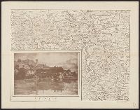
Description:
In bottom right margin: "Cliché dell'Officina Romana." and Inset view of Verdun.
Publisher:
s.n.,
Subject (Geographic):
Verdun (France)--Maps
Found in:
Beinecke Rare Book and Manuscript Library > [Verdun and Environs].
Published / Created:
[Ca. 1612]
Call Number:
Taylor 258
Collection Title:
Descriptio ac delineatio geographica detectionis freti, sive, transitus ad occasum supra terras
Image Count:
1
Description:
Bound in after p. [8]., Map folded irregularly., Printed on recto in lower right corner: B., and Scale [ca. 1:160,000,000].
Subject (Name):
Quieros, Pedro Fernandes de, d. 1615
Subject (Topic):
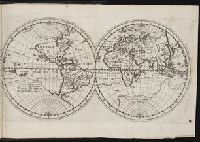
World maps --Early works to 1800
Collection Created:
Amsterodami Ex officina Hesse lij Gerardi. Anno 1613
Found in:
Beinecke Rare Book and Manuscript Library > [World map]
Published / Created:
[Ca. 1612]
Call Number:
Pequot G325
Collection Title:
Descriptio ac delineatio geographica detectionis freti, sive, transitus ad occasum supra terras
Image Count:
1
Description:
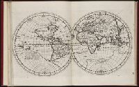
Bound in after p. [8]., Printed on recto: "B" in lower right margin., and Scale [ca. 1:160,000,000].
Subject (Topic):
World maps --Early works to 1800
Collection Created:
Amsterodami Ex officina Hesse lij Gerardi. Anno 1613
Found in:
Beinecke Rare Book and Manuscript Library > [World map]
Branch:v1.61.8 ,Deployed:2024-06-20T11:14:55-04:00