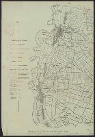
Mappa Aestivarvm insularum, alias Barmvdas dictarum
Description:
Below map, list of proprietors in 12 columns flanked by coats-of-arms., Borders are hand colored., and Not hand colored. With watermark. Sheet measures 46 x 55 cm.
Berghaus, Heinrich Karl Wilhelm, 1797-1884, author Berghaus, Heinrich Karl Wilhelm, 1797-1884. Atlas von Asia Siebert, Selmar, engraver
Call Number:
28 1832
Container / Volume:
BRBL_00023E
Image Count:
1
Resource Type:
Maps, Atlases & Globes
Description:
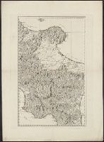
"Berghaus' Atlas von Asia" in upper left corner., Blindstamp: Simon Schropp Co. in Berlin., Relief shown by hachures., and With six inset maps and thirteen coastal profiles.
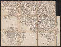
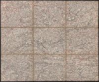
From Woerl's Atlas von Central-Europa, 1830., Imperfect: trimmed along neat line, with loss of marginal data. Dissected and mounted on cloth., Relief shown by hachures., and Title from label on verso.
Subject (Geographic):
Lazio (Italy)--Maps and Rome (Italy)--Maps
Subject (Name):
Herder, Bartholomä, 1774-1839, lithographer and Woerl, Joseph Edmund. Atlas von Central-Europa
From Woerl's Atlas von Central-Europa, 1830., Imperfect: trimmed along neat line, with loss of marginal data. Dissected and mounted on cloth., Relief shown by hachures., and Title from label on verso.
Contents (on title page) lists 27 maps numbered Ia-XX., Included are maps XXI-XXV, which form the supplement to the atlas; they are not listed in the Inhalt on t.p. but are also cited in the Nachricht., Relief shown by hachures., The subscriber to the 22d edition was allowed to order gratis, one map any from the publisher's Atlas der deutschen Bundes-Staaten which might make the entire work more useful to the teacher or pupil; this copy includes map VIII (Preussische Rhein-Provinz) and map IX (Preussische Provinz Westphalen) cf. Nachricht on t.p. verso., and Variations in numbering: no. XVIIb is used twice, for Ostindien mit den Inseln, and for Vorder-Asien und Nil-Land; XIXb is repeated, for Vereinigte Staaten von Nord-America und Canada, and for Vereinigte Staaten von Nord-America und Mexico.