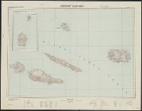
Germany. Heer. Abteilung für Kriegskarten- und Vermessungswesen
Published / Created:
[1942]
Call Number:
212 1942A
Container / Volume:
BRBL_00014
Image Count:
1
Resource Type:
Maps, Atlases & Globes
Description:
-- Azoren-Ost., "Azoren-Mitte und -West" includes inset of Corvo and Flores Islands., "XII. 1942 (D.57).", Azoren-Mitte und -West, German, with Portuguese place names., Includes location map and glossary of Portuguese terms., Librar, and Title supplied by cataloger.
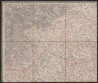
Copy 2: Imperfect: disbound; all sheets but Belluno, Trient, Padua, and Verona wanting; trimmed along neat line, with loss of marginal data. Sheets dissected and mounted on cloth. Stamps on verso: K.K. Un and Relief shown by hachures and spot heights.
Publisher:
Im Verlage der Herder'schen Kunst und Buchhandlung,
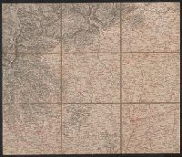
Copy 1: Imperfect: disbound; all sheets but Padua, Verona, and Milano wanting; trimmed along neat line, with loss of marginal data. Sheets dissected and mounted on cloth. and Relief shown by hachures and spot heights.
Publisher:
Im Verlage der Herder'schen Kunst und Buchhandlung,
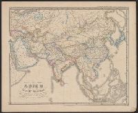
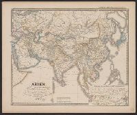
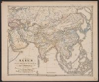
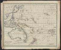
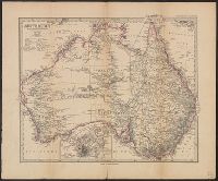
H. Alt & Schröder, engravers Justus Perthes (Firm : Gotha, Germany), publisher Petermann, A. (August Heinrich), 1822-1878 Stieler, Adolf, 1775-1836. Stieler's Hand-Atlas
Published / Created:
[1883?]
Call Number:
26 1883
Container / Volume:
BRBL_00022
Image Count:
1
Resource Type:
Maps, Atlases & Globes
Description:
In German., In lower left margin: Rev. 1883., Map of Australia showing explorers' tracks, railways and telegraph lines. Relief shown by hachures and spot heights., Pr, and Sheet measures 40.5 x 49 cm. Verso: Stamped "Karpinski-von Wieser Map Collection".
Publisher:
Justus Perthes,
Subject (Geographic):
Australia--Discovery and exploration--Maps and Australia--Maps