Subject: Map of the central part of the United States showing the middle Atlantic states, and the Ohio River Valley region. Includes anecdotes on the different Indian nations and the lands. Shows dates of settlements and agreements, locations of quarries,
Alternative Title:
Middle British colonies.
Description:
Differs from other copies in extension of the Connecticut River north beyond "Great Falls." Differs also in coloration of boundaries: Ohio River is colored as a boundary: Pennsylvania is shown as extending north to Lake Ontario, etc. and Shows "West longitude
Publisher:
Printed for Carington Bowles,
Subject (Geographic):
Canada--Maps--Early works to 1800, Middle Atlantic States--Maps--Early works to 1800, Northeastern States--Maps--Early works to 1800, and Ohio River Valley--Maps--Early works to 1800
Subject (Name):
Bowles, Carington, 1724-1793, publisher
Subject (Topic):
British--America--Maps--Early works to 1800 and Chron.--1771
Autograph of Gravely. Autograph of Baldock. Autograph of Aston. Autograph of W. Alington. and Teaching resource: Professor John Mack Faragher, History 141: The American West.
Publisher:
Printed for Thomas Bowles, next to the Chapter-house in St. Paul’s Church-yard, and John Bowles, at the Black Horse in Cornhill ...,
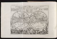
"A continuation ... brought down to the present year 1738 ..." v. 3, p. [649]-784., Frontispiece map, 25 x 41 cm., Imperfect: map opposite p. 425, v.3 wanting., and Map: A plan of Fort St. George and the City of Madras, 25 x 22 cm.
Publisher:
Printed for Messrs. Bettesworth and Hitch; J. Clarke; S. Birt; Tho. Wotton, and J. Shuckburgh; and T. Osborne,
Subject (Geographic):
Madras (India)--Maps--Early works to 1800 and World maps--Early works to 1800
Subject (Name):
Aurangzeb, Emperor of Hindustan, 1618-1707 --Portraits