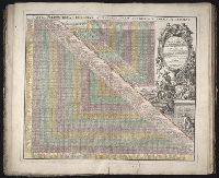
Iimage of the Saints Maurus and Placid surrounded by angels in lower left corner., Publisher statement precedes place of publication in imprint., Relief shown pictorially., and Watermark. Manuscript number in right corner: 42. From the Karpinski-von Wieser Map Collection.
Publisher:
Excusa per Haeredes Homan[n]ianos
Subject (Geographic):
Italy--Maps--Early works to 1800.
Subject (Name):
Benedictines and Benedictines--Italy--Maps--Early works to 1800
Subject (Topic):
Ecclesiastical geography and Ecclesiastical geography--Italy--Maps--Early works to 1800.
Guessefeld, F. L. (Franz Ludwig), 1744-1807 Homann Erben (Firm)
Published / Created:
1775
Call Number:
1983 Folio 23
Collection Title:
[Atlas factice of 50 maps, primarily by Johann Baptist Homann and/or issued by the Homann Erben
Image Count:
1
Publisher:
Impensis Homannianorum Haeredum
Subject (Geographic):
Bohemia (Czech Republic) --Maps --Early works to 1800, Galicia (Poland and Ukraine) --Maps --Early works to 1800, and Ukraine --Maps --Early works to 1800
Hase, Johann Matthias, 1684-1742 Homann Erben (Firm) Lowitz, G. M. (George Moritz), 1722-1774
Published / Created:
1746
Call Number:
1973 Folio 30
Collection Title:
[Atlas factice of 32 maps and 1 distance table, produced by the Homann Erben firm]
Image Count:
1
Alternative Title:
Mappe-monde qui represente les deux hemispheres savoir celui de l’orient et celui de l’occident, tiree des quatre cartes generales de feu M. le profess. Hasius, dressee par Mr. G.M. Lowitz et publiee par les Heritiers de Homann and Planiglobii terrestris mappa vniversalis
Description:
Map colored to show distribution of religions.
Publisher:
[Homann Erben]
Subject (Topic):
Atlases, German --Early works to 1800, Religion --Maps --Early works to 1800, and World maps --Early works to 1800