Search
You Searched For
Search Results
- Published / Created:
- 1793
- Call Number:
- 407 1793
- Container / Volume:
- BRBL_00237
- Image Count:
- 1
- Resource Type:
- Maps, Atlases & Globes
- Publisher:
- Printed for Robert Sayer ... ,
- Subject (Geographic):
- Naples (Kingdom)--Maps--Early works to 1800
- Found in:
- Beinecke Rare Book and Manuscript Library > A new map of Sicily the First, or the kingdom of Naples : drawn with several additions, from Zannoni's map published by order of the King of the Two Sicilies.
- Published / Created:
- 1799
- Call Number:
- 407 1799
- Container / Volume:
- BRBL_00237
- Image Count:
- 1
- Resource Type:
- Maps, Atlases & Globes
- Publisher:
- Published ... by Laurie & Whittle ... ,
- Subject (Geographic):
- Naples (Kingdom)--Maps--Early works to 1800
- Found in:
- Beinecke Rare Book and Manuscript Library > A new map of Sicily the First, or the kingdom of Naples : drawn with several additions, from Zannoni's map published by order of the King of the Two Sicilies.
- Published / Created:
- 1794
- Call Number:
- 90 1794A
- Container / Volume:
- BRBL_00731
- Image Count:
- 2
- Resource Type:
- Maps, Atlases & Globes
- Description:
- Originally printed in 4 sections.
- Publisher:
- Laurie & Whittle,
- Subject (Geographic):
- South America--Maps--Early works to 1800
- Found in:
- Beinecke Rare Book and Manuscript Library > A new map of South America ... from Mr. d'Anville ...
- Published / Created:
- 1820
- Call Number:
- 329 1820
- Container / Volume:
- BRBL_00074
- Image Count:
- 1
- Resource Type:
- Maps, Atlases & Globes
- Description:
- Preliminary record. and Text & View of Swansea.
- Publisher:
- William Darton,
- Subject (Geographic):
- Wales--Maps
- Found in:
- Beinecke Rare Book and Manuscript Library > A new map of South Wales ... Thomas Dix Surveyor ...
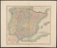
- Published / Created:
- 1811
- Call Number:
- 39 1811
- Container / Volume:
- BRBL_00186
- Image Count:
- 1
- Resource Type:
- Maps, Atlases & Globes
- Publisher:
- J. Cary,
- Subject (Geographic):
- Spain--Maps
- Found in:
- Beinecke Rare Book and Manuscript Library > A new map of Spain and Portugal ... By John Cary, Engraver.
- Published / Created:
- [1852?]
- Call Number:
- 34 1852
- Container / Volume:
- BRBL_00091
- Image Count:
- 1
- Resource Type:
- Maps, Atlases & Globes
- Description:
- Map of Sweden and Norway. Relief is shown by hachures.
- Publisher:
- James Wyld,
- Subject (Geographic):
- Scandinavia--Maps
- Found in:
- Beinecke Rare Book and Manuscript Library > A new map of Sweden and Norway [cartographic material].
- Published / Created:
- 1811
- Call Number:
- 34 1811
- Container / Volume:
- BRBL_00091
- Image Count:
- 1
- Resource Type:
- Maps, Atlases & Globes
- Description:
- Preliminary record.
- Publisher:
- J. Cary,
- Subject (Geographic):
- Scandinavia--Maps
- Found in:
- Beinecke Rare Book and Manuscript Library > A new map of Sweden, Denmark and Norway ... John Cary, Engraver.
- Published / Created:
- 1811
- Call Number:
- 37 1811
- Image Count:
- 1
- Resource Type:
- Maps, Atlases & Globes
- Publisher:
- J. Cary,
- Subject (Geographic):
- Switzerland--Maps
- Found in:
- Beinecke Rare Book and Manuscript Library > A new map of Swisserland ... By John Cary, Engraver.
- Published / Created:
- 1794
- Call Number:
- 37 1794
- Image Count:
- 1
- Resource Type:
- Maps, Atlases & Globes
- Publisher:
- Laurie & Whittle,
- Subject (Geographic):
- Switzerland--Maps--Early works to 1800
- Found in:
- Beinecke Rare Book and Manuscript Library > A new map of Switzerland ... Thirteen Cantons with their Allies & their subjects.