Duetecum, Baptista Linschoten, Jan Huygen van, 1563-1611
Published / Created:
1595]
Call Number:
212 A64 1595
Container / Volume:
BRBL_00014
Image Count:
1
Resource Type:
Maps, Atlases & Globes
Description:
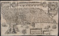
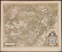
Bird's-eye-view., Dedicated to Cristóbal de Mauro by Jan Huygen van Linschoten., In lower left: J 50 en J 51., Includes text and ill., and Relief shown pictorially.
Publisher:
s.n.,
Subject (Geographic):
Angra do Heroísmo (Azores)--Aerial views--Early works to 1800
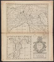
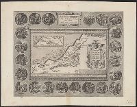
"Dedicated to His Highness William Duke of Glocester.", Appears in E. Wells' A new sett of maps both of antient and present geography., English, with Latin place names., Has watermark., Includes ornamental cartouche., and Relief shown pictorially.
Publisher:
s.n.,
Subject (Geographic):
Italy--Historical geography--Maps--Early works to 1800, Italy--History--To 476--Maps--Early works to 1800, and Rome--Maps--Early works to 1800
Subject (Name):
Nicholls, Sutton and Wells, Edward, 1667-1727. New sett of maps both of antient and present geography
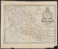
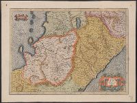
"Dedicated to His Highness William Duke of Glocester.", Appears in E. Wells' A new sett of maps both of antient and present geography., English, with Latin place names., Includes ornamental cartouche., Relief shown pictorially., and Watermarks: RDS, and fleur-de-l
Publisher:
s.n.,
Subject (Geographic):
Italy--Historical geography--Maps--Early works to 1800, Italy--History--To 476--Maps--Early works to 1800, and Rome--Maps--Early works to 1800
Subject (Name):
Nicholls, Sutton and Wells, Edward, 1667-1727. New sett of maps both of antient and present geography
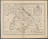
New sett of maps both of antient and present geography ...
Container / Volume:
BRBL_00041
Image Count:
1
Resource Type:
Maps, Atlases & Globes
Alternative Title:
New map of the British Isles, showing their ancient people, cities and towns of note in the time of the Romans
Description:
"Sutton Nicholls sculp.", Appears in Edward Wells's New sett of maps both of antient and present geography (1701)., Imprint derived from the atlas in which the map was issued., Kingdoms with boundaries, settlements with Latin names and rivers., and London meridia
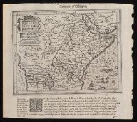
"Privilegio Imperiali, Regio, et Belgico decennali, 1586.", Appears in the author's Theatrum orbis terrarum. 1595., Dedicated to Iohannes Moflinius by Abraham Ortelius., and Includes ill. in medallions surrounding map depicting scenes from Abraham's life and ins
Publisher:
Officina Plantiniana,
Subject (Geographic):
Palestine--History--Maps--Early works to 1800
Subject (Name):
Abraham--(Biblical patriarch), Abraham--(Biblical patriarch)--Travel--Maps--Early works to 1800, Moflinius, Iohannes, and Ortelius, Abraham, 1527-1598. Theatrum orbis terrarum