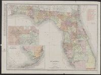
Rand, McNally & Co.'s New business atlas map of Florida
Description:
Includes table for identifying marked Florida railroads., Insets: Map showing part of Lake, Orange & Volusia Counties. [Scale ca. 1:321,870] -- Southern portion of Florida. [Scale ca. 1:1,203,840]., Prime meridian: Greenwich., and Relief shown by hachures.
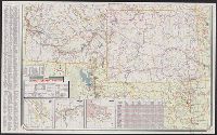
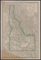
"0-5648-6.", At head of title: Sinclair., Includes indexes, ill., insets of "Waterton-Glacier International Peace Park, Alta.-Mont." and "Yellowstone and Grant Teton national parks, Wyo.," distance table, 3 local route maps, and text., and Relief shown pictorial
Publisher:
Rand McNally,
Subject (Geographic):
Idaho--Maps, Montana--Maps, and Wyoming--Maps
Subject (Name):
Sinclair Oil Corporation
Subject (Topic):
Roads--Idaho--Maps, Roads--Montana--Maps, and Roads--Wyoming--Maps
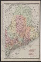
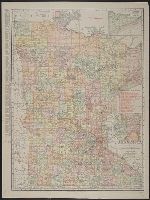
Rand McNally & Co.'s new business atlas map of Maine. and Rand-McNally indexed atlas.
Description:
Includes key to railroads., Indicates electric lines and steamship lines., Relief shown by hachures., and Title from copyright statement: Rand, McNally & Co.'s new business atlas map of Maine.
Publisher:
Rand, McNally & Co.,
Subject (Geographic):
Maine--Maps
Subject (Topic):
Electric lines--Maine--Maps, Railroads--Maine--Maps, and Steamboat lines--Maine--Maps
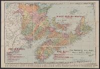
Rand, McNally & Co.'s New Brunswick, Nova Scotia, and Prince Edward Island and Rand, McNally & Co.'s New Business Atlas Map of the Maritime Provinces of Canada
Description:
"Copyright 1909, by Rand, McNally & Co. Copyright 1892, by Rand, McNally & Co.", Includes index of chief cities with their populations., Relief shown by hachures., and Shows railroads, lighthouses, counties, cities and towns, mountains, lakes, and rivers.
Publisher:
Rand, McNally & Co.,
Subject (Geographic):
New Brunswick--Maps, Nova Scotia--Maps, and Prince Edward Island--Maps
Subject (Topic):
Counties--New Brunswick--Maps, Counties--Nova Scotia--Maps, Lighthouses--New Brunswick--Maps, Lighthouses--Nova Scotia--Maps, Lighthouses--Prince Edward Island--Maps, and Railroads--New Brunswick--Maps
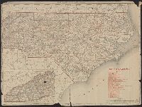
Rand, McNally & Co.'s New 11 x 14 map of North Carolina
Description:
Inset: Western portion of North Carolina)., Prime meridian: Greenwich., Printed in red: "North Carolina Railroads", Relief shown by hachures., and Verso:Index to counties and cities, figures on the extent of land and water areas, and population statistics.
1904 war map of Japan, Korea, and China, 1904 war map of Russia and the continent of Asia, and Rand, McNally & Co.'s 1904 war map of Russia and the continent of Asia
Description:
Indexed. and Relief shown by hachures and spot heights.