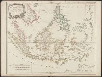
From Philippe Vandermaelen's Atlas universel de géographie physique, politique, statistique et minéralogique (1827)., Includes descriptive note., Prime meridian: Paris., and Relief shown pictorially.
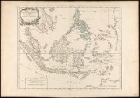
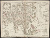
Covers present-day Indonesia, the Philippines, Malayan peninsula, Indo-Chinese peninsula, and north-west coast of Australia., From: Atlas universel / par m. Robert geographe et Robert de Vaugondy son fils. Paris, 1757-[1786]., Includes inset map., and Inset: Isl
Publisher:
[publisher not identified],
Subject (Geographic):
Asia--East Indies, Australia--Maps--Early works to 1800., East Indies--Maps--Early works to 1800., Mariana Islands--Maps--Early works to 1800., and Southeast Asia--Maps--Early works to 1800.
Subject (Name):
Haye, G. de la, engraver. and Robert de Vaugondy, Gilles, 1688-1766. Atlas universel.
"Archipel des Indes" stamped twice on verso., Appeared in: Gilles and Didier Robert de Vaugondy, "Atlas Universel", 1753-1757 [or later]., Covers present-day Indonesia, the Philippines, Malayan peninsula, Indo-Chinese peninsula, and north-west coast of Australia., Includes inset map., Inset: Isles Marianes des Larons., Relief shown pictorially., and Watermarks.
Publisher:
[publisher not identified],
Subject (Geographic):
Southeast Asia--Maps--Early works to 1800.
Subject (Name):
Haye, G. de la, engraver., Robert de Vaugondy, Didier, 1723-1786. Atlas Universel., and Robert de Vaugondy, Gilles, 1688-1766. Atlas universel.
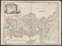
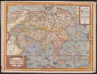
Appears in the author's Cosmographie universelle., Hand col. Sheet measures 37 x 49 cm. Lanman Collection., Includes ill., text., and Relief shown pictorially.
Publisher:
P. l'Huillier,
Subject (Geographic):
Asia--Maps--Early works to 1800
Subject (Name):
L'Huillier, Pierre and Thevet, André, 1502-1590. Cosmographie universelle