Skip to search
Skip to main content
Skip to first result
Search
You Searched For
Extent of Digitization
Completely digitized
Publication Place
[London] :
New Search
Search Results
Creator:
Published / Created:
[1912]
Call Number:
533 1912A
Container / Volume:
BRBL_00287
Image Count:
1
Resource Type:
Maps, Atlases & Globes
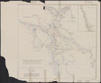
Description:
"This map is taken from that given in the portfolio of "Plans of the irrigation of Mesopotamia" (no. 2) by Sir Wm. Willcocks ...", From the papers of Oscar Terry Crosby., In lower right corner: Lower Mesopotamia--Willcocks., and In upper right margin: Geographic
Publisher:
Royal Geographical Society,
Subject (Geographic):
Iraq--Maps
Subject (Name):
Crosby, Oscar Terry, 1861-1947 and Royal Geographical Society (Great Britain)
Found in:
Beinecke Rare Book and Manuscript Library > Lower Mesopotamia [cartographic material] / from surveys made under the direction of Sir William Willcocks, K.C.M.G., 1909-1911.
Creator:
Published / Created:
1918
Call Number:
5683 1918
Container / Volume:
BRBL_00300
Image Count:
1
Resource Type:
Maps, Atlases & Globes
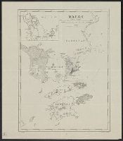
Description:
"G.S.G.S. No. 2874.", "War Office, July 1918.", and Shows Macao and nearby Chinese territory.
Publisher:
[GSGS, War Office],
Subject (Geographic):
Macao (China)--Maps
Subject (Name):
Great Britain. War Office. General Staff. Geographical Section
Found in:
Beinecke Rare Book and Manuscript Library > Macao.
Published / Created:
1802
Call Number:
60 1802A
Container / Volume:
BRBL_00324
Image Count:
1
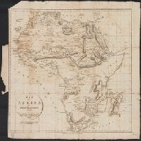
Resource Type:
Maps, Atlases & Globes
Publisher:
R. Phillips,
Subject (Geographic):
Africa--Maps
Found in:
Beinecke Rare Book and Manuscript Library > Map of Africa for Dr. Mayor's Universal History ...
Creator:
Published / Created:
[1854?]
Call Number:
70 1854
Container / Volume:
BRBL_00359
Image Count:
1
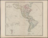
Resource Type:
Maps, Atlases & Globes
Description:
Date below publisher statement erased. Date inferred from listing on p. 113 of Phillips, Maps of America, as map 57 in Wyld's New general atlas. [1854], Library's copy stamped on verso: Yale University Library, Karpinski-Von Wieser Map Collection., and Prime me
Publisher:
James Wyld, geographer to Her Majesty, Charing Cross East,
Subject (Geographic):
Western Hemisphere--Maps
Found in:
Beinecke Rare Book and Manuscript Library > Map of America.
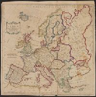
Creator:
Published / Created:
1783
Call Number:
30 1783
Container / Volume:
BRBL_00029
Image Count:
1
Resource Type:
Maps, Atlases & Globes
Description:
Hand col. Preliminary record. and Map Collection acquisition record: *090.
Publisher:
T. Cadell,
Subject (Geographic):
Europe--Maps--Early works to 1800
Found in:
Beinecke Rare Book and Manuscript Library > Map of Europe divided into its empires, kingdoms, &c. / by Thos. Kitchin ...
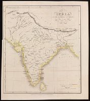
Published / Created:
1817
Call Number:
59 1817
Container / Volume:
BRBL_00317
Image Count:
1
Resource Type:
Maps, Atlases & Globes
Publisher:
Baldwin, Cradock & Joy,
Subject (Geographic):
India--Maps
Found in:
Beinecke Rare Book and Manuscript Library > Map of Hindoostan, drawn for Mills History of British India by A. Arrowsmith. Engraved by Sid Hall.
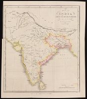
Creator:
Published / Created:
Octr. 17th, 1842.
Call Number:
BrSides 2019 77
Image Count:
1
Resource Type:
Maps, Atlases & Globes
Description:
"The British possessions are coloured red ... native states yellow." and Relief shown by hachures.
Publisher:
Published as the act directs by Wm. H. Allen & Co., 7 Leadenhall St.,
Subject (Geographic):
Great Britain--Colonies--India--Maps. and South Asia--Maps
Subject (Name):
J. & C. Walker (Firm), engraver and W.H. Allen & Co., publisher
Found in:
Beinecke Rare Book and Manuscript Library > Map of India : shewing the British possessions in the year 1750 / by Juland Danvers ; J. & C. Walker, sculpt.
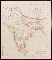
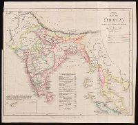
Creator:
Published / Created:
Octr. 17th, 1842.
Call Number:
BrSides 2019 76
Image Count:
1
Resource Type:
Maps, Atlases & Globes
Description:
"The British possessions are coloured red ... native states yellow." and Relief shown by hachures.
Publisher:
Published as the act directs by Wm. H. Allen & Co., 7 Leadenhall St.,
Subject (Geographic):
Great Britain--Colonies--India--Maps. and South Asia--Maps
Subject (Name):
J. & C. Walker (Firm), engraver and W.H. Allen & Co., publisher
Found in:
Beinecke Rare Book and Manuscript Library > Map of India : shewing the British possessions in the year 1784 / by Juland Danvers ; J. & C. Walker, sculpt.
Creator:
Published / Created:
Octr. 17th, 1842.
Call Number:
BrSides 2019 75
Image Count:
1
Resource Type:
Maps, Atlases & Globes
Description:
"The British possessions are coloured red ... native states yellow." and Relief shown by hachures.
Publisher:
Published as the act directs by Wm. H. Allen & Co., 7 Leadenhall St.,
Subject (Geographic):
Great Britain--Colonies--India--Maps. and South Asia--Maps
Subject (Name):
J. & C. Walker (Firm), engraver and W.H. Allen & Co., publisher
Found in:
Beinecke Rare Book and Manuscript Library > Map of India : shewing the British possessions in the year 1792 / by Juland Danvers ; J. & C. Walker, sculpt.
Creator:
Published / Created:
Decr. 1st, 1842.
Call Number:
BrSides 2019 78
Image Count:
1
Resource Type:
Maps, Atlases & Globes
Description:
"The British possessions are coloured red, native states yellow, French purple, Portuguese orange, Danish brown, Dutch blue, states under British protection green." and Relief shown by hachures.
Publisher:
Published as the act directs by Wm. H. Allen & Co., 7 Leadenhall St.,
Subject (Geographic):
Great Britain--Colonies--India--Maps. and South Asia--Maps
Subject (Name):
J. & C. Walker (Firm), engraver and W.H. Allen & Co., publisher
Found in:
Beinecke Rare Book and Manuscript Library > Map of India : shewing the British possessions in the year 1842 / by Juland Danvers ; J. & C. Walker, sculpt.
Branch:v1.61.6 ,Deployed:2024-06-12T09:55:36-04:00