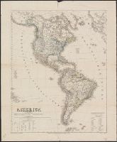
Geographisches Institut (Weimar, Thuringia, Germany) Kiepert, Heinrich, 1818-1899 Weiland, C. F. (Carl Ferdinand), -1847, cartographer
Published / Created:
[1855?]
Call Number:
26 1855
Container / Volume:
BRBL_00022
Image Count:
1
Resource Type:
Maps, Atlases & Globes
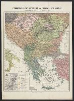
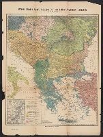
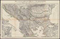
Description:
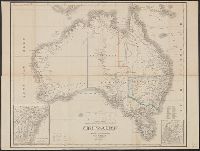
Hand col. Sheet measures 50 x 64.5 cm., In German., Insets: [1.] Neu Süd Wales -- [2.] Colonie Süd-Australia., Prime meridians: Ferro, Greenwich and Paris., and Top right-hand corner: "67".
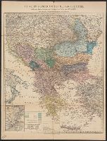
Accompanied by: Erläuterungen zur Karte. 1 p. ; 31 cm., Accompanying text wanting., Includes inset: Constantinopel und der Bosporus., and Relief shown by spot heights and hachures.
Publisher:
Verlag von Dietrich Reimer,
Subject (Geographic):
Balkan Peninsula--Maps
Subject (Name):
Bischoff, C, Dietrich Reimer Verlag (Berlin, Germany), and Sulzer, J