Relation de ce qui s'est passé en la Nouvelle France en l'année 1638.
Description:
Sig.: 2 l. not signed, A-D in eights, E-F in fours, A-D in eights, E in two.
Publisher:
Chez Sebastien Cramoisy,
Subject (Geographic):
Canada--History--To 1763 (New France) and New France--Discovery and exploration.
Subject (Name):
Jesuits. Correspondence from North America., Jesuits. Letters from misssions (North America), Jesuits--Missions., and Le Mercier, François, 1604-1690.
Subject (Topic):
Indians of North America--Missions., Indians--Missions--North America., and Wyandot Indians--Missions.
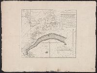
Described as an untitled French translation of an unknown Mount and Page chart annotated by Benjamin Franklin in preparation for publication in London in De Vorsey's Imago mundi article. and Includes text, shows latitude and longitude figures in right and bot
Publisher:
Chéz Le Rouge, rue des Grands Augustine ...,
Subject (Geographic):
Gulf Stream--Maps--Early works to 1800
Subject (Name):
Franklin, Benjamin, 1706-1790
Subject (Topic):
Nautical charts--Atlantic Coast (North America)--Early works to 1800
Mariette, Pierre, 1603-1657, publisher Sanson, Nicolas, 1600-1667, cartographer Sanson, Nicolas, 1600-1667. Cartes générales de toutes les parties du monde Tavernier, Melchior, -1641
Published / Created:
1637
Call Number:
314 1637
Container / Volume:
BRBL_00038
Image Count:
1
Resource Type:
Maps, Atlases & Globes
Description:
Appeared in Sanson's Cartes générales de toutes les parties du monde (1658)., No 3: Imperfect: chewed in upper right corner, with no loss of text. Sheet measures 45.2 x 62.3 cm., Prime meridian: Ferro., Relief shown pictorially., and Watermark.
Publisher:
par M. Tauernier graueur & imprimeur du roy et a present chez Pierre Mariette rue S. Iacques a l'esperance,
Subject (Geographic):
Africa, North--Maps--Early works to 1800, Europe, Southern--Maps--Early works to 1800, and Middle East--Maps--Early works to 1800
"Avec privilege.", Appeared in Anville's Atlas général., Imperfect: Mutilated wih loss of text. Hand colored. Sheets joined. Manuscript note in unidentified hand., Includes seven bar scales., and Relief shown pictorially.
Publisher:
Chez l'Auteur aux Galerie du Louvre,
Subject (Geographic):
Asia--Maps--Early works to 1800.
Subject (Name):
Anville, Jean Baptiste Bourguignon d', 1697-1782. Atlas général. and Haye, G. de la
Clumnitz Chateau, 7 x 9., Einbogen, Chateau de Brandeis, Budweiss, Eger, Kolin, Leutmaritz, Pilsen, Thabor., Insets: Prag, Ville Capitale, ca 1:45,000, 11 x 15., and Koniggratz [Hradec Králové], 7 x 9.
Publisher:
Chez le Sr. le Rouge,
Subject (Geographic):
Bohemia (Czech Republic)--Maps--Early works to 1800
"Avec privilege du Roi". and Insets: [1.] Sault du Niagara, de 135 pieds de haut -- [2. Map of Louisiana territory] -- [3. Map of Mississippi River region].
Publisher:
[Georges-Louis le Rouge], rue des Augustins,
Subject (Geographic):
North America--Maps--Early works to 1800 and United States--History--Revolution, 1775-1783--Maps--Early works to 1800